A late-season snowstorm moved through the upper midwest on the 16th/17th of April, dropping up to 18″ of snow over northern Minnesota and northern Wisconsin. The storm and its aftermath produced IFR conditions; how did the GOES-R IFR Probability field do?

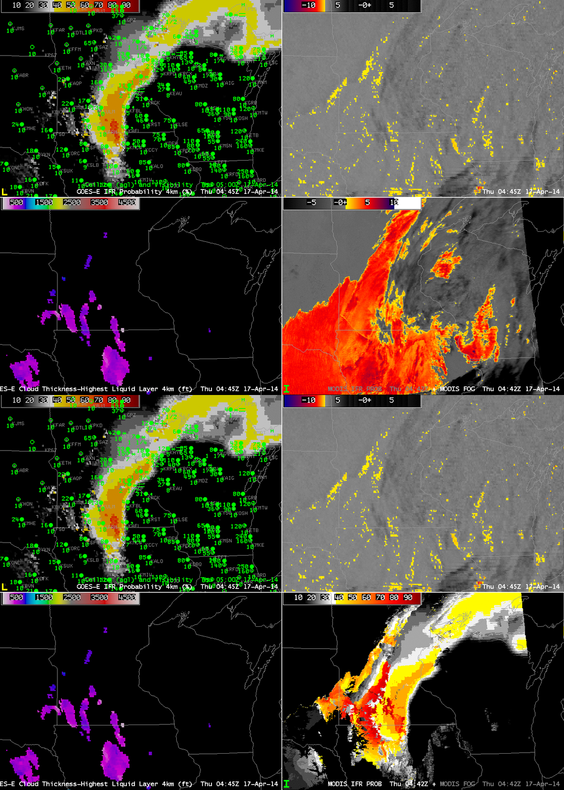
GOES-R IFR Probabilities computed from GOES-East (Upper Left), GOES-East Brightness Temperature Differences (10.7 µm – 3.9 µm) (Upper Right), GOES-R Cloud Thickness (Lower Left), Toggle between GOES-R IFR Probabilities computed from MODIS and MODIS Brightness Temperature Difference Fields (Lower Right), times as indicated (click to enlarge)
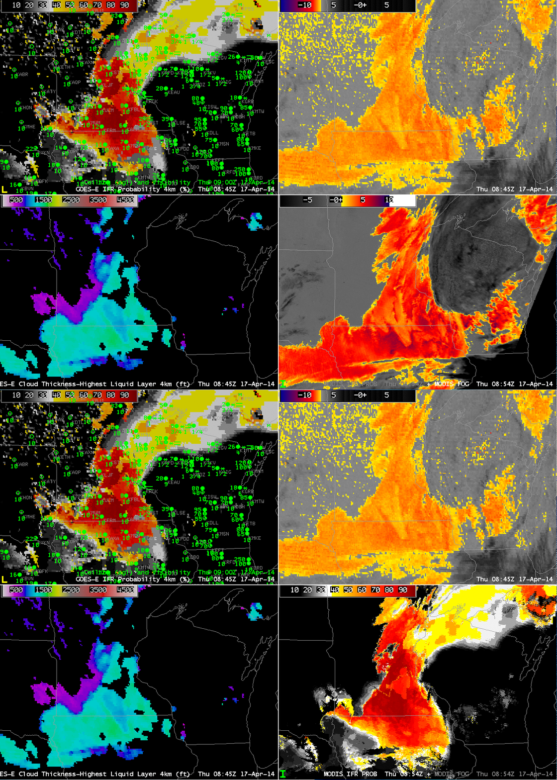
The toggle above shows data from ~0445 UTC on 17 April. The MODIS Brightness Temperature Difference field suggests stratus over a large region where IFR conditions are not observed; the IFR Probability fields better approximate the regions of low ceilings/reduced visibilities. The inclusion of Rapid Refresh model data better defines regions of low-level saturation so that the IFR Probability Fields (compared to the brightness temperature difference fields) are better aligned with low ceilings/reduced visibilities. Imagery at ~0900 UTC, below, shows an expansion of the IFR conditions over southern Minnesota as the storm moves away. Note also how IFR Probabiilties are enhanced over northern Wisconsin, where multiple cloud layers make the traditional fog/low cloud detection mechanism, the brightness temperature difference field, difficult. Probabilities are smaller there because the satellite predictors cannot be used in the algorithm that computes IFR Probabilities, and the variability of the values is less, reflecting the smoother fields present in the model (compared to the pixels of the satellite data).

GOES-R IFR Probabilities computed from GOES-East (Upper Left), GOES-East Brightness Temperature Differences (10.7 µm – 3.9 µm) (Upper Right), GOES-R Cloud Thickness (Lower Left), Toggle between GOES-R IFR Probabilities computed from MODIS and MODIS Brightness Temperature Difference Fields (Lower Right), times as indicated (click to enlarge)
