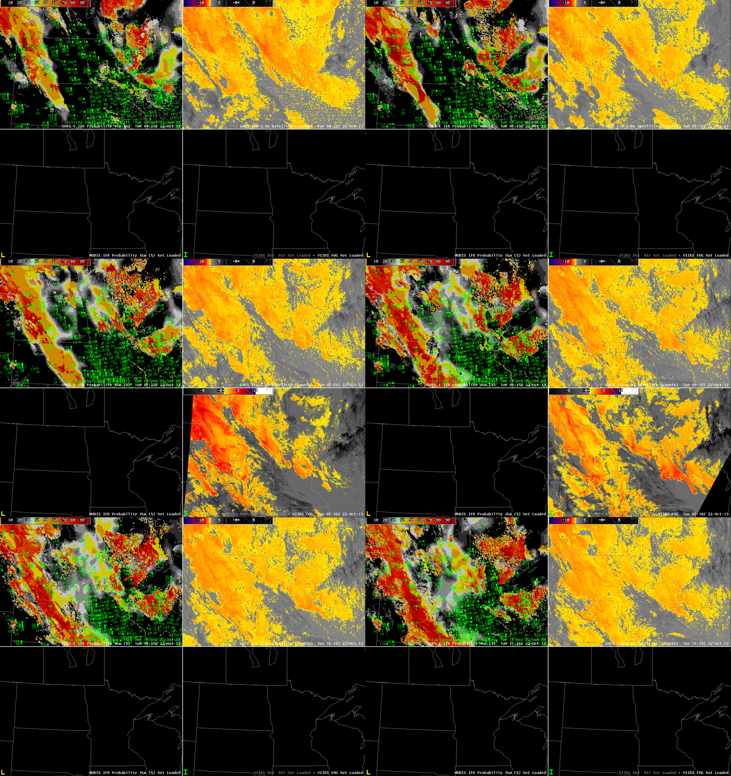
GOES-13-based GOES-R IFR Probabilities (Upper Left), GOES-13 Brightness Temperature Difference Product (10.7 µm – 3.9 µm) (Upper Right), MODIS-based GOES-R IFR Probabilities (Lower Left), Suomi-NPP Brightness Temperature Difference (11.35 µm – 3.74 µm) (Lower Right), all times as indicated (click image to enlarge)
The animation above shows GOES-R IFR Probabilities highest in a band that stretches mostly north-south from western North Dakota into central South Dakota. IFR conditions are observed under and near this band, for example at Stanley, North Dakota. The occasional MODIS-based IFR Probabilities also suggest that IFR conditions are most likely over the western Dakotas. Both GOES-based and MODIS-based IFR Probability fields de-emphasize the regions of enhanced brightness temperature difference (in both GOES and Suomi-NPP Fields) that exist over western Minnesota and the central and eastern Dakotas. In these regions, mid-level stratus is being detected by the satellite. The Rapid Refresh model is correctly diagnosing the clouds as elevated, and that model information is used to de-emphasize (correctly) the possibility of IFR conditions. IFR and near-IFR conditions also occur over parts of northeast Minnesota into northwest Wisconsin where IFR probabilities are higher.

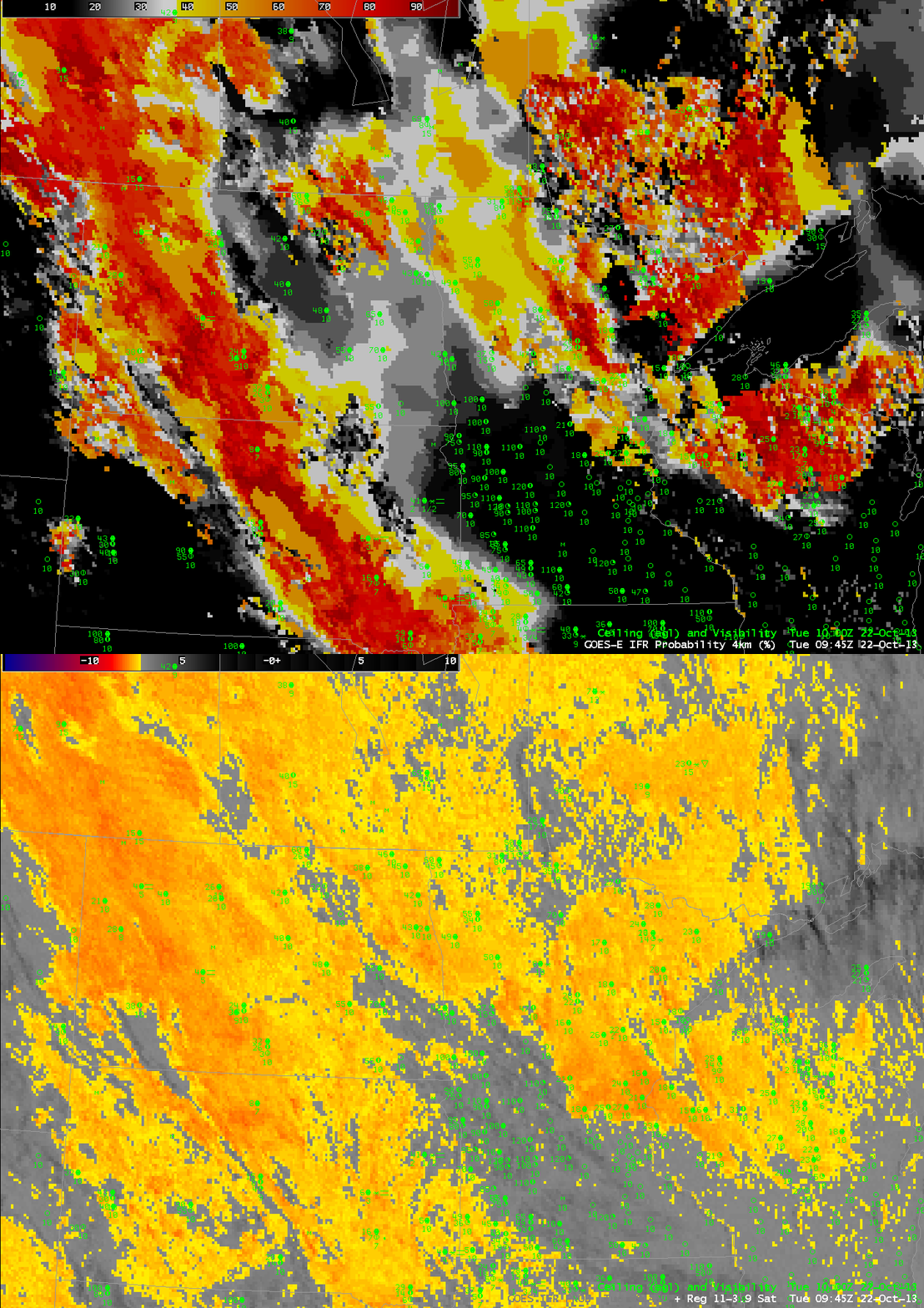
Toggle between GOES-13-based GOES-R IFR Probabilities and GOES-13 Brightness Temperature Difference (10.7 µm – 3.9 µm) at 0945 UTC on 22 October (click image to enlarge)
A limitation of the traditional brightness temperature difference product is highlighted above in the toggle between the GOES-R IFR Probability and the Brightness Temperature Difference at 0945 UTC. Mid-level stratus and low stratus/fog look nearly identical in the brightness temperature difference product, but the latter is very significant for aviation. Thus the need to better highlight regions of IFR conditions by using the fused data product that incorporates surface information by way of the Rapid Refresh model.
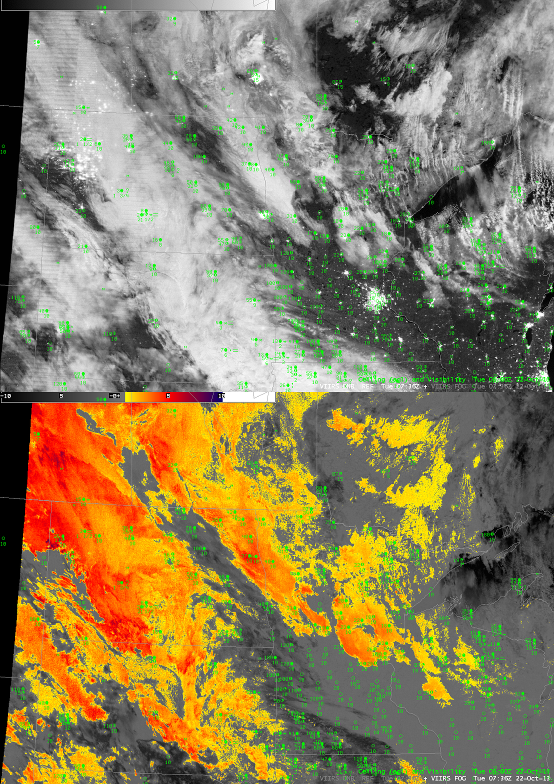
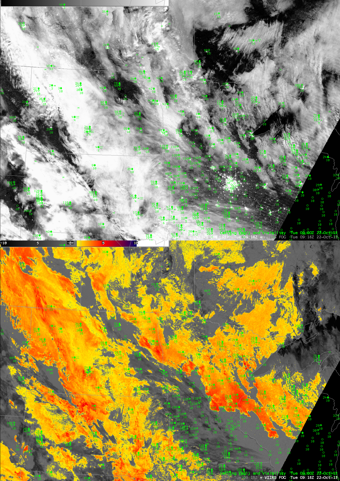
Lunar illumination is particularly strong at this time (Full moon occurred late last week), so the day/night band on Suomi/NPP gives compelling visible imagery. As with the case with brightness temperature difference products, however, it can be difficult to distinguish between mid-level stratus and low stratus in the Day/Night band. Toggles between the Day/Night band and the Brightness Temperature Difference from Suomi/NPP is at both 0736 and 0918 UTC are below. Work proceeds on incorporating Suomi/NPP data into the GOES-R IFR Probability algorithm.


