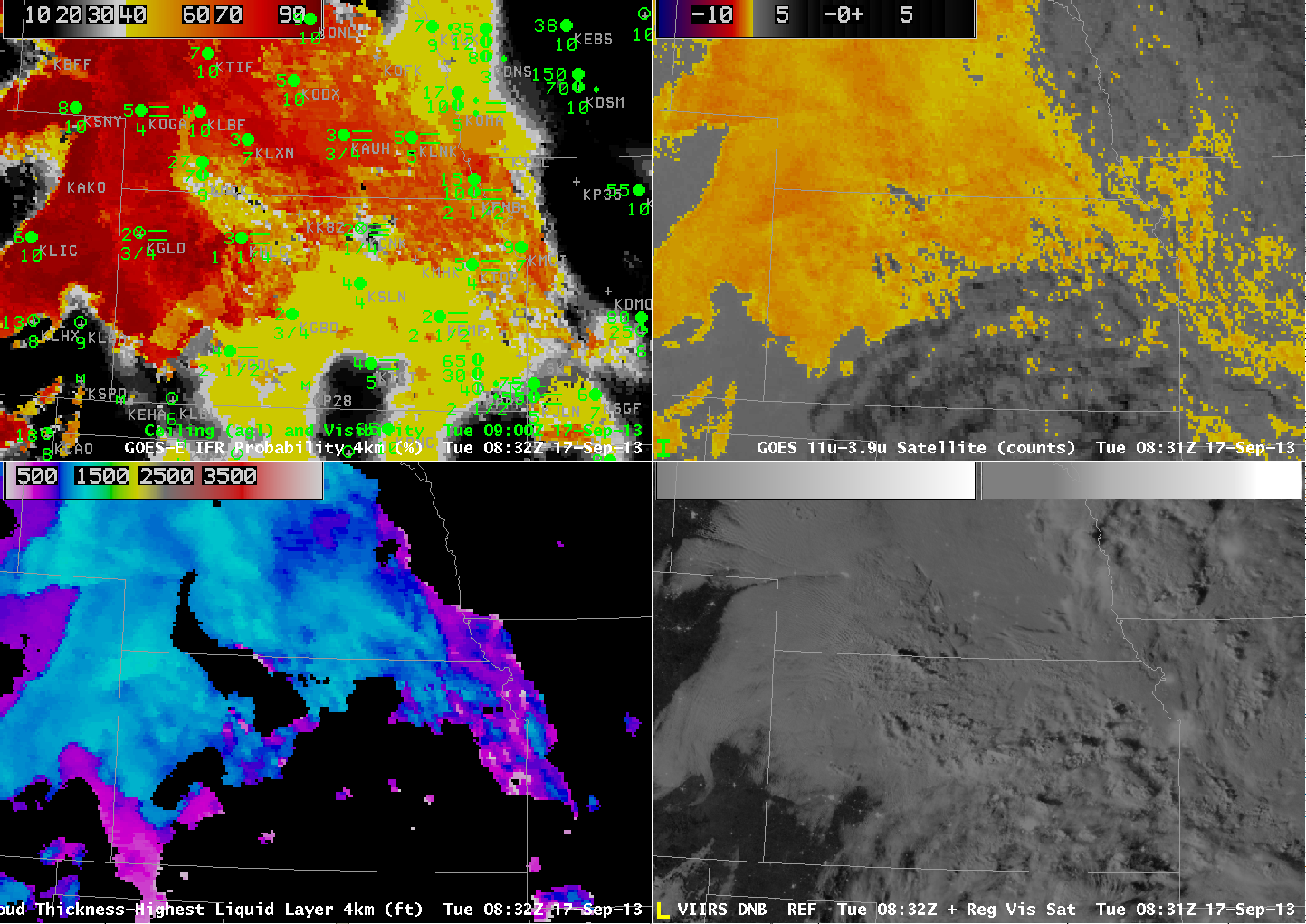
GOES-R IFR Probability (Upper Left), GOES-East Brightness Temperature Difference (Upper Right), GOES-R Cloud Thickness (Lower Left), Suomi/NPP Day/Night Band (Lower Right), all imagery at ~0830 UTC on 17 September 2013 (click image to enlarge)
Light winds with a small upslope component allowed for the formation of fog over the High Plains on the morning of 17 September 2017. The image above shows the GOES-R IFR Probability, GOES-East Brightness Temperature Difference (10.7 µm – 3.9 µm), the GOES-R Cloud Thickness and the Day/Night band from Suomi/NPP that provides for nighttime visible imagery. In the imagery above, a large region over southeastern Kansas is overlain by higher ice-based clouds (likely cirrus) such that the brightness temperature difference product does not give the signal that is common with fog and low stratus (in the enhancement used here, fog and low stratus occur where the brightness temperature difference is colored orange or yellow). The Day/Night band visible imagery also suggests high clouds over southeast Kansas. Surface observations do show reduced visibilities, at or near IFR conditions. In this region, the IFR Probability Product gives useful information by using Rapid Refresh Data to diagnose the possibility of low-level fog. The probabilities are smaller — in the 40- to 50% range — but that is because no satellite data are being used as predictors. IFR Probabilities are very high only if both predictors — satellite and Rapid Refresh — are associated with high probability of fog/low stratus.
Note also how the Cloud Thickness product yields no information where high clouds are present. The Cloud Thickness is the thickness of the highest liquid cloud layer; the presence of ice clouds or mixed phase clouds precludes the determination of how thick a water cloud is because the satellite cannot view the water-based cloud.
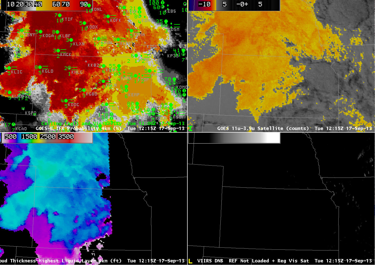
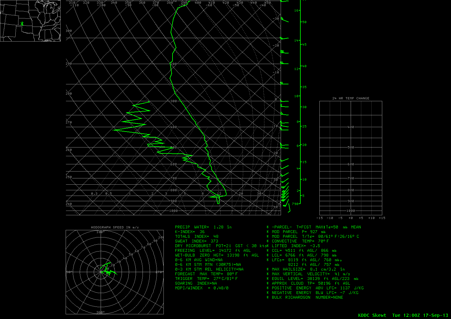
The 1215 UTC image shows the effect of twilight conditions moving westward across Kansas — GOES-R Cloud Thickness is not computed during twilight conditions that occurring over eastern Kansas, although they are still computed around Dodge City, where the computed cloud thickness is just over 1000 feet thick. The 1200 UTC Sounding from Dodge City, below, does show a nearly-saturated layer at the surface (about 927 mb, or about 2700 feet ASL) up to about 870 mb (4600 feet ASL).


