The National Weather Service in Taunton, MA, tweeted an image of fog over coastal southern New England early on September 3rd. How well did the GOES-R IFR Probability detect this event?
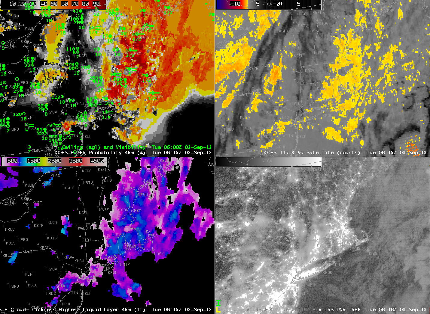
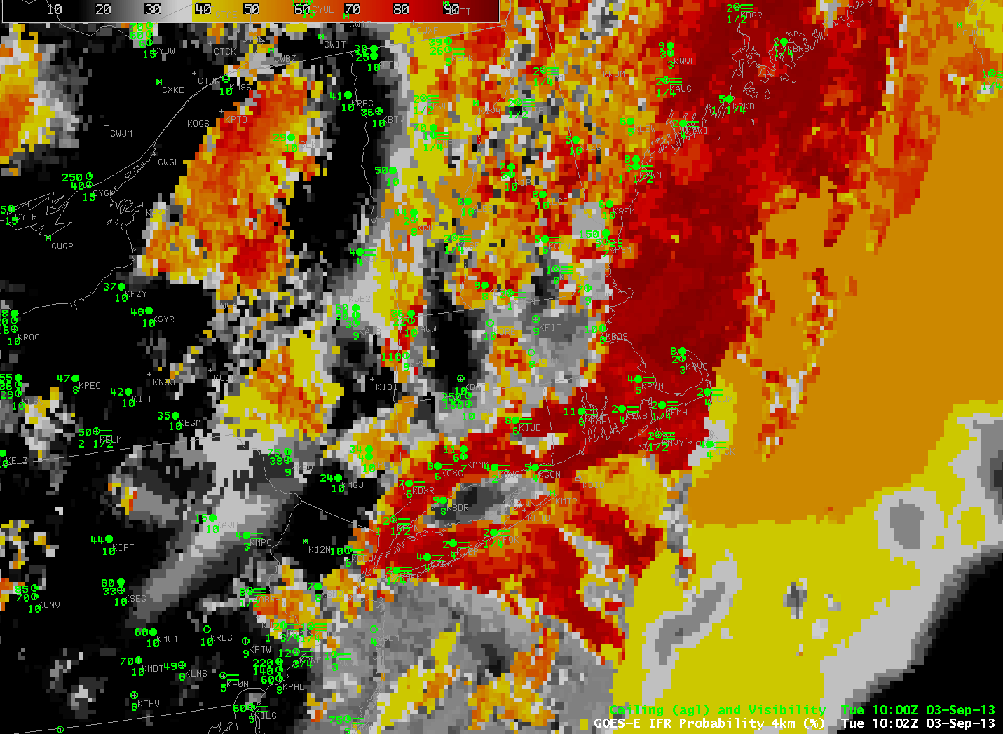
The animation, above, at hourly time-steps (GOES-R IFR Probability is computed every 15 minutes, usually, but matching surface observations occur only hourly) can be used to validate the accuracy of the IFR Probability product: highest probabilities in the animation are occurring over coastal New England where visibility is lowest. The increase in probabilities from 1002 UTC to 1102 UTC over the Gulf of Maine reflects the night-time (1002 UTC) vs. daytime (1102 UTC) predictors being used in the IFR Probability algorithm. The flat nature of the IFR probability field over parts of the Gulf of Maine suggests that model data only is being used to compute the IFR probability field there. This occurs where high clouds obscure the satellite view of low clouds.

GOES-R IFR Probability (Upper Left), GOES-East Brightness Temperature Difference (Upper Right), GOES-R Cloud Thickness (Lower Left), Suomi/NPP Day/Night Band (Lower Right) (click image to play animation)
The brightness temperature difference fields in the animation above (click image to see the animation) have a characteristic appearance associated with high clouds south and east of Cape Cod. In fact, Nantucket is mostly overlain by high clouds. The presence of those high clouds makes satellite detection of fog/low stratus difficult, but a fused/blended product such as the GOES-R IFR probability field that combines satellite and model data is able to alert an observer to the presence of reduced visibilities.
The GOES-R Cloud Thickness (Lower left in the animation above) gives an estimate to the depth of the highest water-based cloud layer. This product is not computed during twilight conditions — from about 1015 to 1215 UTC in the animation above. The animation clearly shows the thickest fog/low stratus deck moving eastward through southeast New England during the early morning hours.
The Suomi/NPP Day/Night band allows for visible imagery at night, detecting visible moonlight and Earthglow that is reflected off clouds, and also emitted light from cities. The 0615 UTC image is here. Clouds are visible in the image, but there is no information on the level of the cloud.
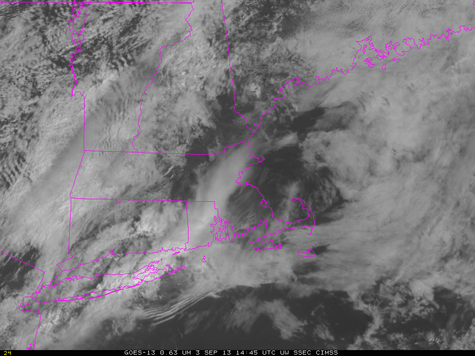
Visible imagery from after sunrise shows the low clouds persisting south of New England. In addition, a bore (manifest as a series of parallel lines) propagates south of an area of convection that appears to have spawned the bore.


