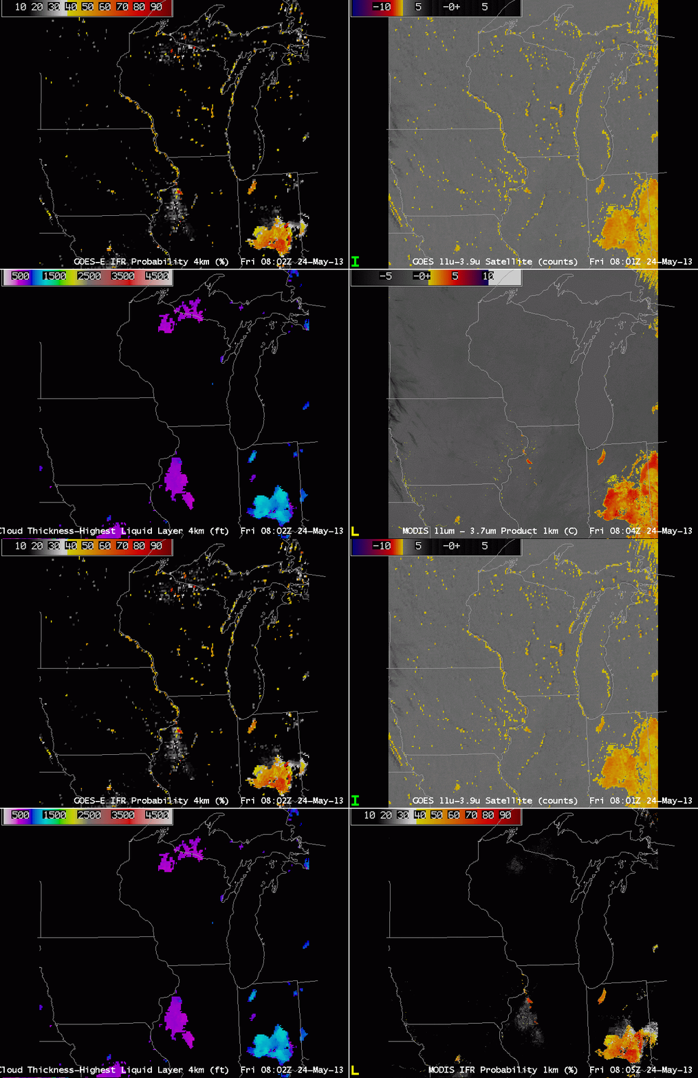
GOES-13 has a co-registration error between the 10.7 and 3.9 µm channel. That is, the two different channels do not view the same identical pixel. There is expected to be some variance (at the sub-pixel scale), but the differences exceed system specifications. This error is also present in GOES-14, as shown above. The brightness temperature difference product from GOES-14 (upper right) erroneously depicts the presence of Fog/Low Stratus along the western shores of Lakes Michigan and Winnebago and others, and along the various river valleys. A MODIS image at the same time does not indicate low clouds at all. The GOES imagery suggests clouds because of the coregistration error: one channel sees the water and one sees the land, so the difference is actually a land-sea temperature difference rather than one due to emissivity differences between the two wavelengths for water clouds.
The error in GOES propagates into the GOES-R IFR probability fields as a thread of higher probability paralleling the water. Cloud Thickness fields do not show the signal, however.
This example shows the benefit of using two different satellites to view the same scene. An misalignment in one typically is not present in the second.

