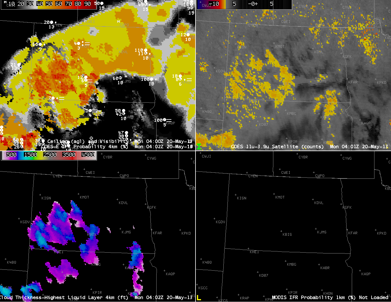
When multiple cloud layers are present, the traditional method of detecting fog, the brightness temperature difference between the 10.7 µm and 3.9 µm channels on the GOES Imager, will fail. For such a configuration of clouds, the GOES-R IFR Probability field will yield information because it also uses information from the Rapid Refresh model to predict whether fog is possible. The image above contains regions where both model and satellite data are used to compute the IFR probability, and where model data only are used. How can you differentiate between the two?
Regions over southwest North Dakota are not overlain by high clouds. In those regions, a strong signal in the brightness temperature difference fields is present. There is also a north-south oriented signal over extreme southeast North Dakota and northeast South Dakota. In both of those regions, the Cloud Thickness product is predicting a thickness. Such a prediction works only when low clouds are visible by the satellite.
The GOES-R IFR Probability field, in the upper left, contains regions where both satellite and model are used (and these mostly overlay the regions where the Cloud Thickness field is present) and where only model data are used (because the satellite signal for low clouds is blocked by mid- and high-level clouds). The horizontal homogeneity of the field over northeast North Dakota is characteristic of GOES-R IFR Probability fields that are determined largely by model data only. Compare that to the more pixelated field over southwest North Dakota where Cloud Thickness fields are also computed: Pixelation is a hallmark of the use of satellite data in the prediction of the IFR Probability.
 |
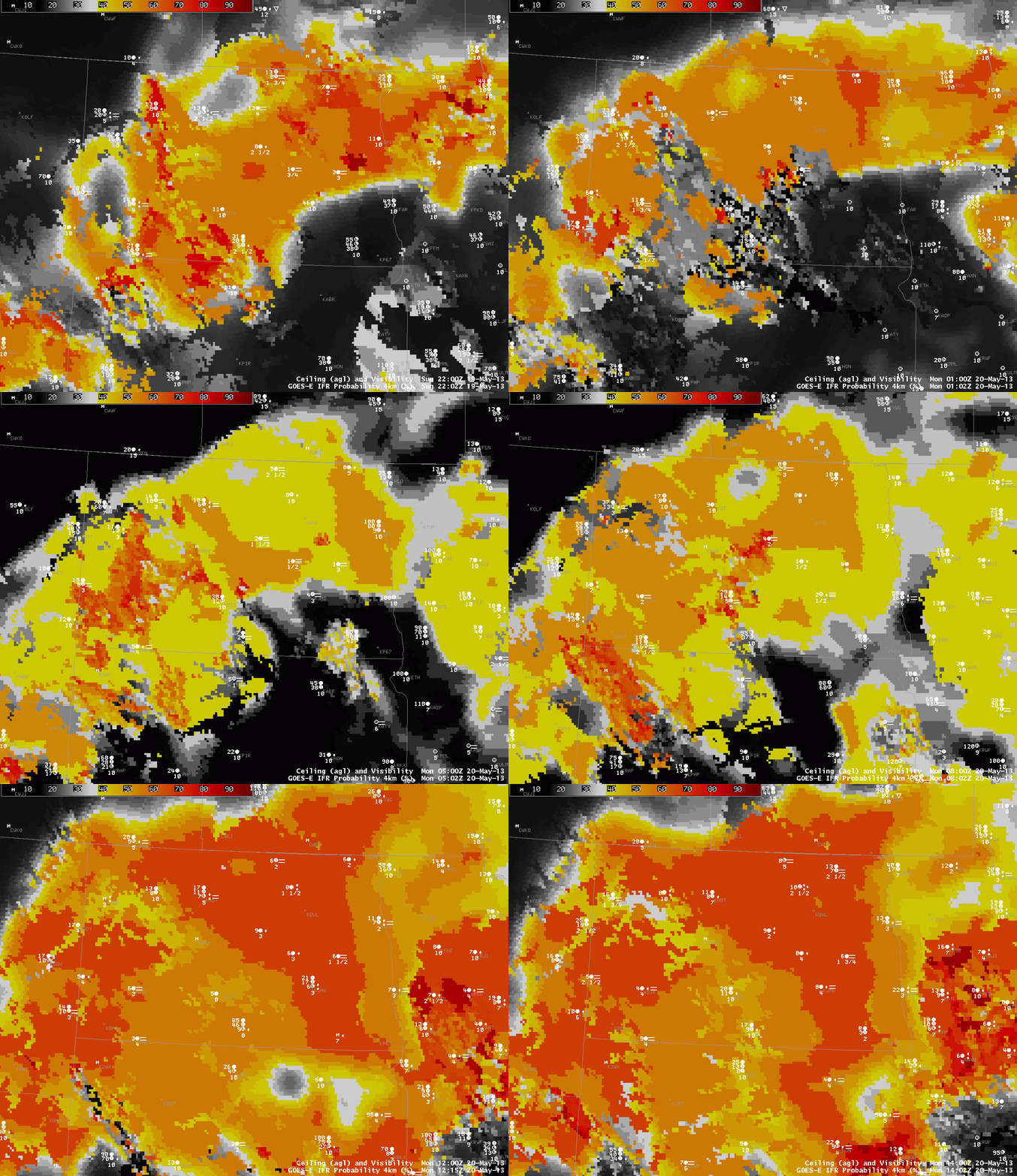
| Hourly evolution of GOES-R IFR Probability (with surface plots of ceiling/visibility) over North Dakota, 2202 UTC 19 May through 1402 UTC 20 May 2013 |
The GOES-R IFR probability field accurately depicts the region of IFR conditions over northeast North Dakota that is separate from southeast North Dakota where higher ceilings/visibilities are present. (Consider the observations at Jamestown, ND (KJMS), for example). As nighttimes progresses, IFR probabilities increase over most of the state. The switch from daytime predictors (initially) to nighttime predictors is apparent in the 0202 UTC image (the terminator slants southwest to northeast). The switch back to daytime predictors occurs between the 1102 UTC and 1215 UTC imagery.

