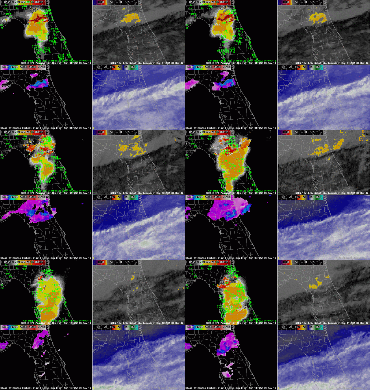
Fog developed over central Florida overnight underneath a thin cirrus (as indicated by both the water vapor and brightness temperature difference imagery). Cirrus clouds prevent the traditional brightness temperature difference field from identifying low fog/stratus because the high ice clouds are detected rather than the developing low-level water clouds. This is a case, then, when a fused product gives needed surface information to help diagnose the development of fog and low stratus. The brightness temperature difference product, the traditional method to detect fog and low stratus, is giving no information where dense fog is forming.
On this date, the development and expansion of the higher IFR probabilities over central Florida neatly matches the development of IFR conditions at the observing stations. Probabilities are not high because the satellite predictors are not contributing to the algorithm. It is important when interpreting the IFR probabilities to be aware of the presence of high clouds that will influence IFR probability values. Where the cirrus clouds are not present, notably over northeast Florida, IFR probabilities are much higher because satellite predictors there are contributing to the final probability.
This case also shows that the Cloud Thickness is only computed where the highest clouds detected is a water-based cloud. Underneath the cirrus shield, except for a few regions where there are apparently holes, cloud thickness is not computed.
 |
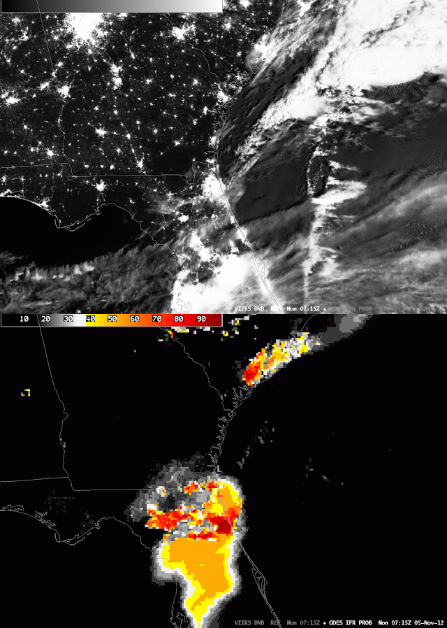
| GOES-R IFR Probabilities and Day/Night Band from VIIRS on Suomi/NPP, 0715 UTC 5 Nov |
The toggle above flips between the Day-Night band from VIIRS on Suomi/NPP and the GOES-R IFR probability at the same time. The thin cirrus shield is readily apparent, and the regions of fog are also visible in the Day/Night band over north-central Florida and over coastal South Carolina.
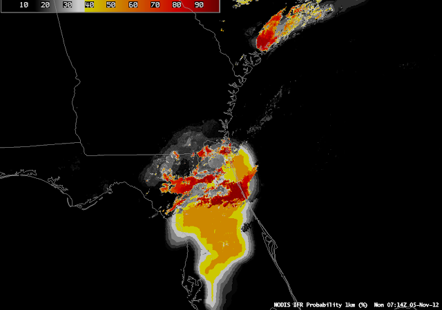
A MODIS-based IFR Probability (shown below) was also created at 0715 UTC, and it shows a pattern similar to that above. The pixelated part of the image corresponds to where satellite data are being used. The region with lower values, and a flatter field, was created using only model predictors and, as noted above, is characterized by lower probabilities. The highest probabilities are in regions where both satellite and model predictors are very confident that IFR conditions are present.
 |
| MODIS-based GOES-R IFR Probabilities, Monday 5 Nov 2012, 0714 UTC |

