 |
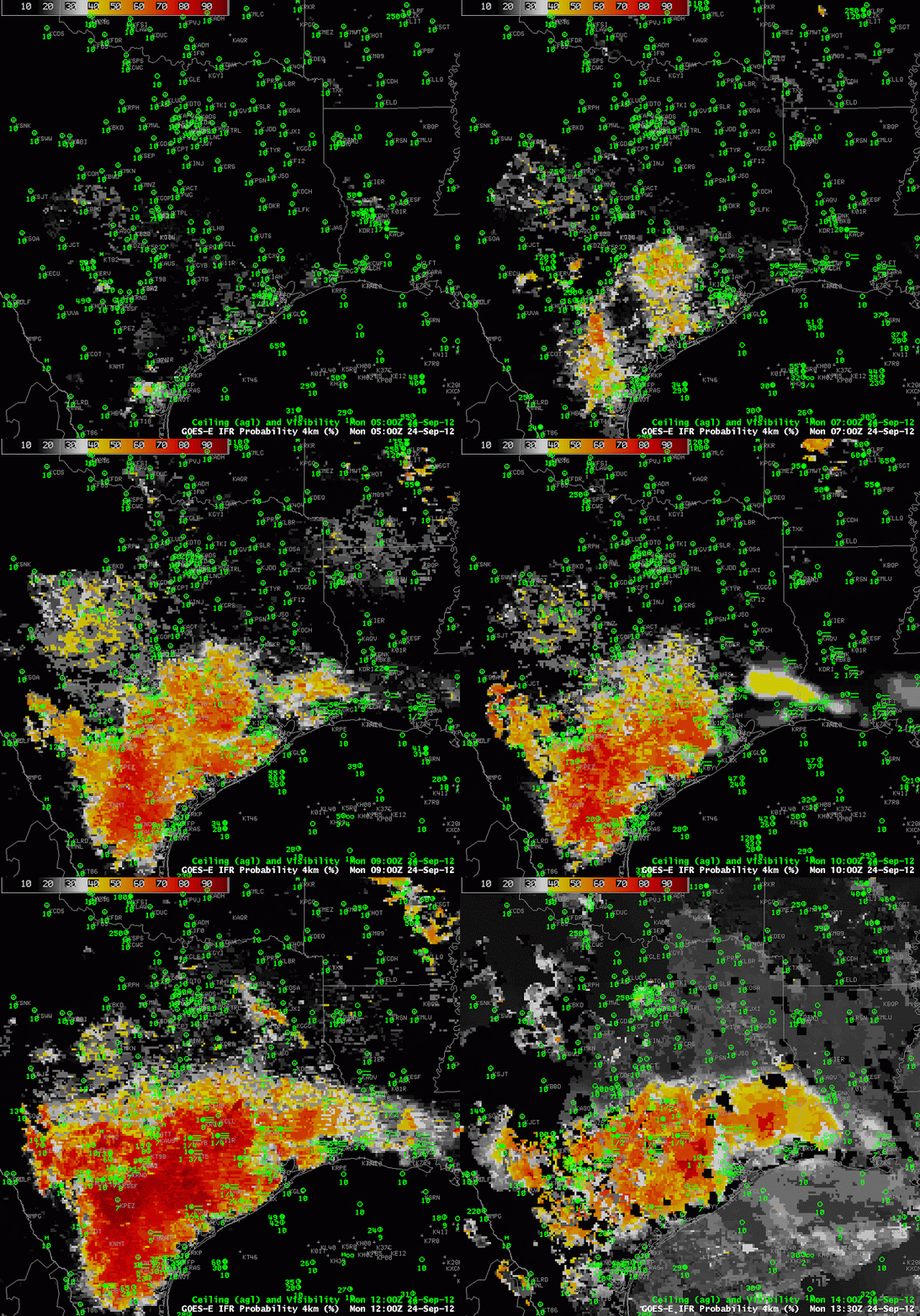
| GOES-R IFR Probabilities computed with GOES-West during the morning of Sep 24 2012 |
GOES-13 was placed in standby after experiencing an anomaly on Sunday, so all GOES-R IFR Probabilities are being computed with GOES-West data; GOES-15 is in FD mode, acquiring a full disk each half hour to provide coverage for CONUS. GOES-15 data did detect the development of fog/low stratus over southern/coastal Texas and Louisiana overnight under the presence of light winds and high dewpoints. The regions of highest probabilities correspond well with IFR conditions. The 1330 UTC image, at the end, shows a noticeable drop in coverage as the daytime predictors replace the nighttime predictors (this includes using the visible imagery as a cloud mask).
