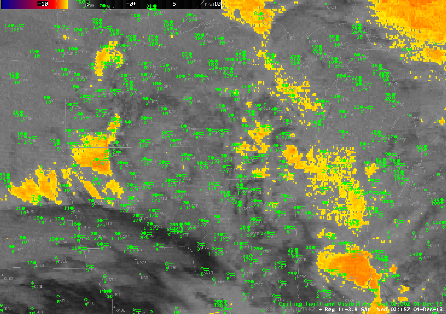
Toggle between nighttime GOES-R IFR Probabilities from GOES-13 and GOES-13 Brightness Temperature Differences (10.7 µm – 3.9 µm) at 0215 UTC on 4 December 2013 (click image to enlarge)
Dense advection fog developed in the upper midwest on Tuesday 3 December 2013 and persisted into December 4th as a Colorado Cyclone moved into central Wisconsin, drawing moist air over cold ground. The IFR Probability Product, a product that fuses together the 3.9 µm pseudo-emissivity (nighttime only) from satellites (a signal similar to the 3.9-11 µm brightness temperature difference field, which gives little information on low clouds in this situation) with model data from the Rapid Refresh (which suggests widespread fog), accurately depicts the large region of advection fog that led to dense fog advisories over parts of Wisconsin and Iowa and surrounding states (see below).
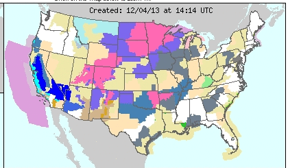
Cropped Screenshot from http://www.crh.noaa.gov at 1414 UTC on 4 December 2013 that shows widespread Dense Fog Advisories over the Upper Midwest

Daytime GOES-R IFR Probabilities computed from GOES-13, 2145 UTC on 3 December 2013 (click image to enlarge)
The dense fog was present late in the day on December 3rd, 2013, and the IFR Probability fields reflected that. However, in the image above, there are isolated pixels with very low probabilities mixed in with the high probabilities over Wisconsin and surrounding states where advection fog was widespread. Why?
This storm had multiple cloud layers, which can make detection of low cloud difficult from satellite (above) when sun angles are low (sunrise/sunset). The IFR Probability image above is at 3:45 PM local time, and the sun is low in the sky. Deep shadows are being cast and the dark shadowed regions in the visible are misinterpreted by the cloud-clearing algorithm as clear skies. During the day the GOES-R fog/low stratus algorithm relies on the cloud mask to determine where clouds are. Where clear skies are detected (erroneously, in this case), IFR Probabilities are not calculated because fog/low stratus are not expected to be present. Thus, if you see pixelated fields such as the one above, and the sun is low in the sky, this likely means cloud shadows are causing the cloud mask to erroneously return clear sky, which in turn leads to very low IFR probabilities. The animation below cycles through IFR Probability and visible imagery (with a regular enhancement and with a low-light enhancement). After sunset, the cloud shadows are gone and the probability field fills in (as can be seen in the 0215 UTC imagery at the top of this post).
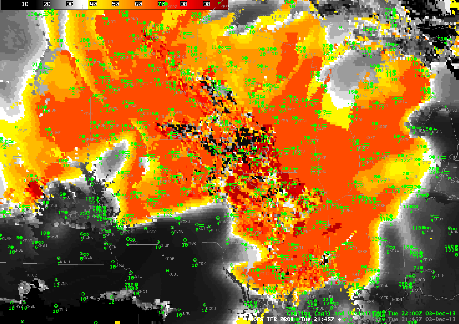
Daytime GOES-R IFR Probabilities computed from GOES-13 at 2145 UTC on 3 December 2013 and the corresponding Visible Imagery (click image to enlarge)