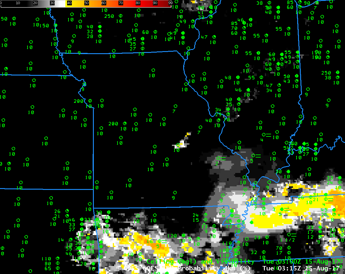
GOES-R IFR Probability Fields, and surface reports of Ceilings and Visibilities, hourly from 0315 to 1315 UTC on 15 August 2017 (Click to enlarge)
GOES-R IFR Probabilities are computed using Legacy GOES (GOES-13 and GOES-15) and Rapid Refresh model information; GOES-16 data will be incorporated into the IFR Probability algorithm in late 2017
IFR Conditions and Dense Fog developed over southeastern Missouri during the early morning on 15 August 2017, leading to the issuance of Dense Fog Advisories. GOES-R IFR Probabilities, above, showed increasing values as the ceilings lowered and visibilities dropped. The IFR Probability fields over southern Missouri and northern Arkansas (and Kansas and Oklahoma) have the characteristic uniformity that arises when Rapid Refresh data alone are used to drive the IFR Probability values. In these regions, high clouds (associated with convection over Arkansas) are blocking the satellite view of lower clouds.
Such high clouds will make it difficult for a satellite-only product to identify the regions of clouds. For example, the Brightness Temperature Difference field below (10.3 µm – 3.9 µm) from GOES-16, color-enhanced so that low clouds are green and that cirrus (at night) are purple) shows widespread low cloudiness at the start of the animation, including some obvious river fog over Missouri (river valleys that are not well-resolved with GOES-13), but developing convection over Arkansas eventually prevents the view of low clouds.
GOES-16 data posted on this page are preliminary, non-operational and are undergoing testing

GOES-16 Brightness Temperature Difference field (10.3 µm – 3.9 µm), hourly from 0312 to 1312 UTC on 15 August 2017 (Click to enlarge)
Because the Brightness Temperature Difference field (helpfully called the ‘Fog’ Channel Difference in AWIPS) is challenged by high clouds in viewing the low clouds, RGB Products that use the brightness temperature difference field are also similarly impeded by high clouds. Consider, for example, the stations in southern Missouri shrouded by the cirrus shield. IFR Conditions are occurring there and a strong signal of that appears in the IFR Probability fields.
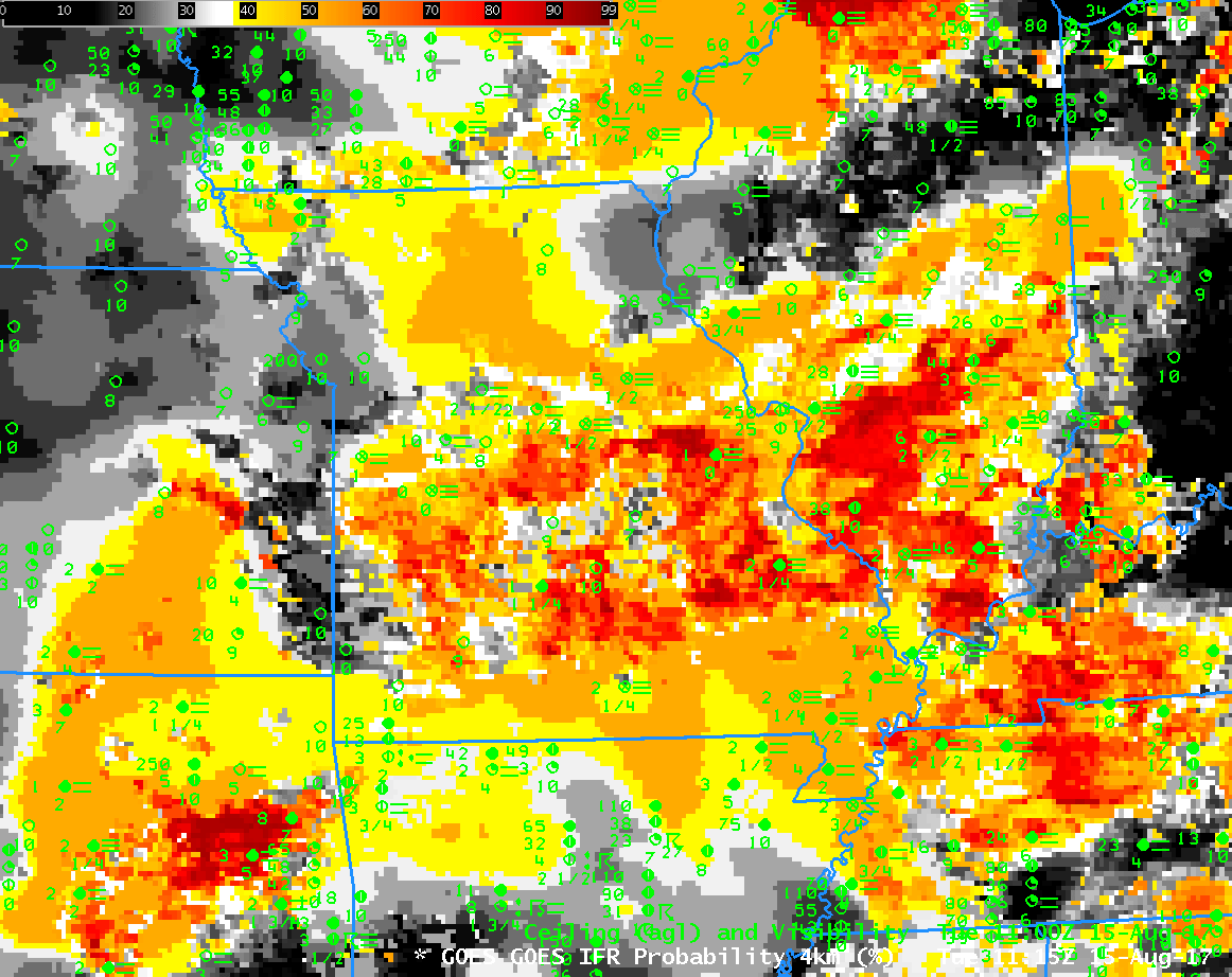
GOES-R IFR Probability computed with GOES-13 and Rapid Refresh Data, GOES-16 Fog (10.3 µm – 3.9 µm) Brightness Temperature Difference and GOES-16 Advanced Nighttime Microphysics RGB, all near 1115 UTC on 15 August 2017 (Click to enlarge)