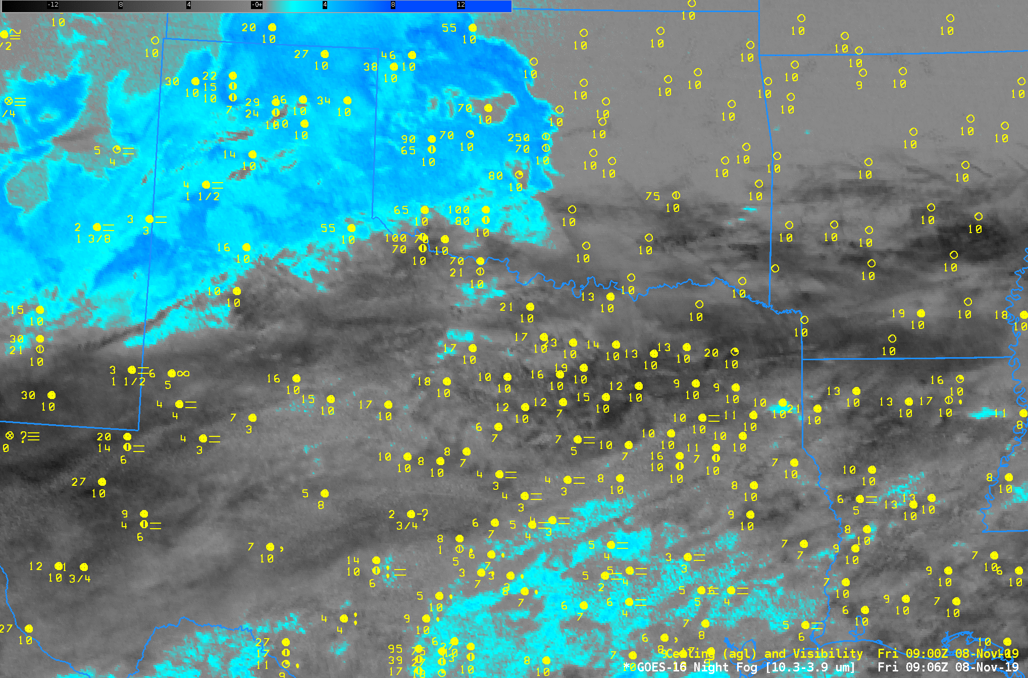
GOES-16 Night Fog Brightness Temperature Difference (10.3 µm – 3.9 µm) at 0906, 1006, 1106, 1206, 1306 and 1401 UTC on 8 November 2019 (Click to enlarge)
Consider the stepped 1-hour images of the ‘Night Fog’ Brightness Temperature Difference (10.3 – 3.9) field, above. (Here’s one with full temporal resolution) Extensive jet stream cirrus is preventing GOES-16 from seeing evidence of low clouds, and the satellite alone is therefore failing to identify regions of low ceiling and fog over much of Texas. (The Nighttime Microphysics RGB that depends on the Night Fog brightness temperature difference to detect low clouds suffers from a similar shortcoming here : link )
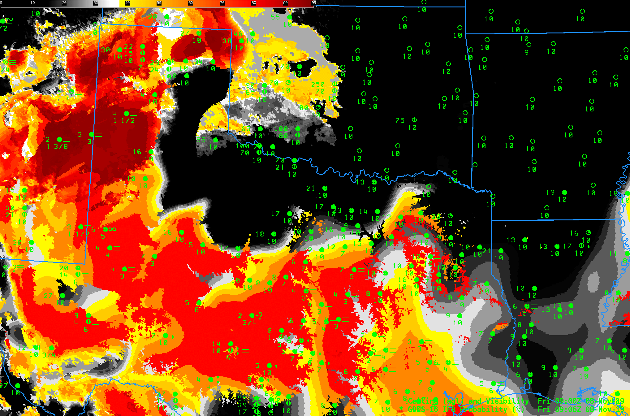
When Cirrus covers an area of low clouds, GOES-R IFR Probability does allow for low cloud/fog detection because it incorporates low-level saturation information from the Rapid Refresh to delineate regions of fog. Similarly, it can screen out regions of mid-level stratus that can appear as fog in both the Night Fog brightness temperature difference and the Nighttime Microphysics RGB: Note the region around Childress TX, for example, where IFR Probability is low, but where the Night Fog Brightness Temperature Difference has a strong signal in the presence of elevated stratus. Regions around Midland are highlighted in IFR Probability — Rapid Refresh data there are correctly diagnosing low ceilings and reduced visibilities. (Here’s IFR Probability with an animation at full temporal resolution). Because Rapid Refresh model data input into the IFR Probability computation changes every hour, you will sometimes see a pulsing in the imagery.
Use IFR Probability to detect regions of low ceilings and reduced visibility when cirrus has overspread your area.

GOES-R IFR Probability at 0906, 1006, 1106, 1206, 1306 and 1401 UTC on 8 November 2019 (Click to enlarge)