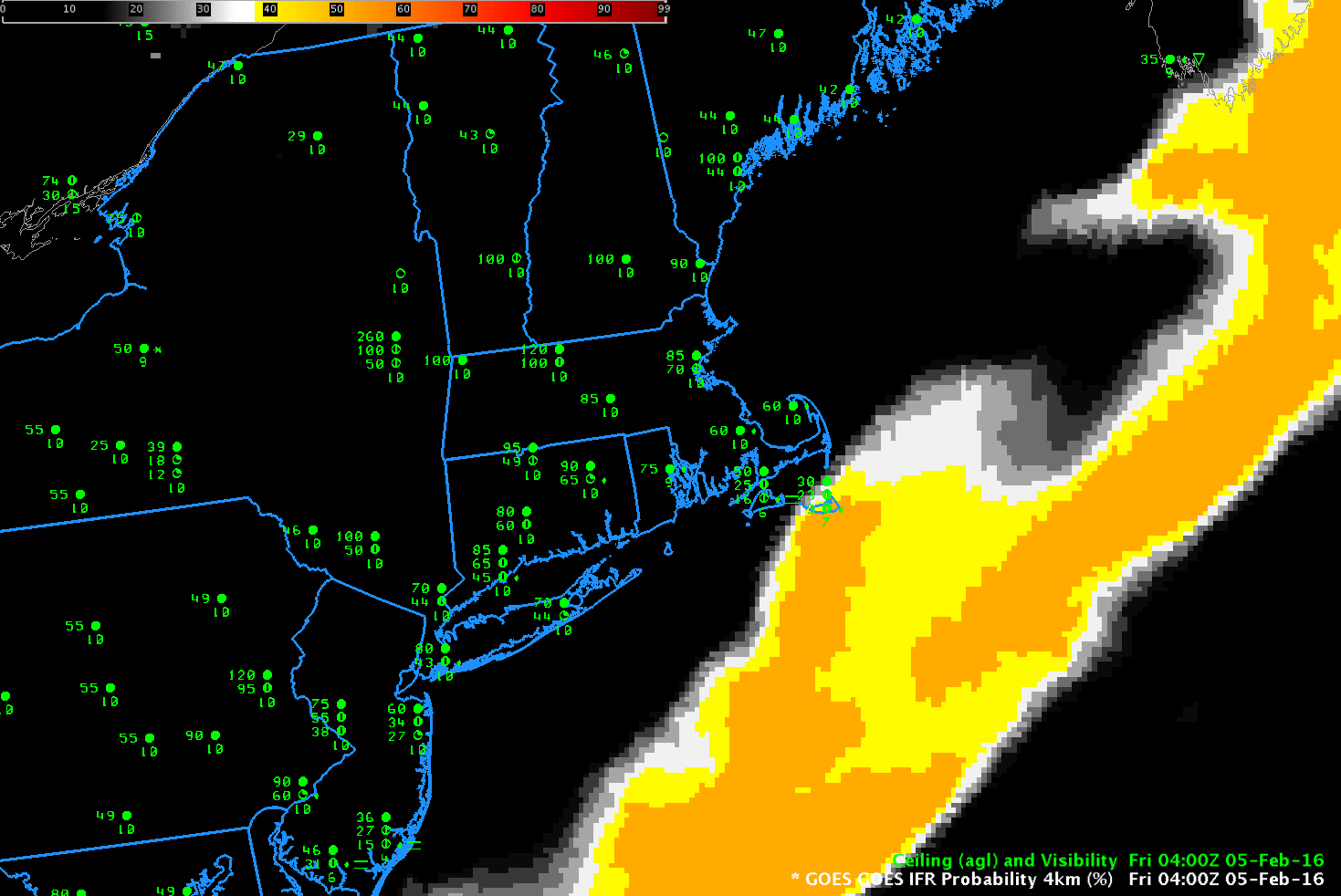
GOES-R IFR Probabilities, hourly from 0400 through 1515 UTC, 5 February 2016 (Click to enlarge)
IFR Conditions frequently occur with storms along the East Coast. Satellite detection of such conditions is very difficult because of the multiple cloud layers that accompany cyclogenesis. The IFR Probabilities, above, have a character that reflects their determination solely from Rapid Refresh Data. That is, Satellite Predictors were not considered over much of New England because of the presence of multiple cloud layers, as suggested in the Water Vapor animation below.
IFR Probability fields are initially entirely offshore in the animation above, and IFR conditions are not observed over southern New England. Note how IFR probabilities initially increase over land over southern New Jersey and then quickly move northeastward into southern New England as IFR Conditions develop. Because satellite predictors are unavailable in these regions (on account of the many clouds layers), the simultaneous development of high IFR Probabilities with observed IFR Conditions argues for a good simulation of the observed weather by the Rapid Refresh. Fused data products such as IFR Probability fields join the strengths of different systems to provide a statistically more robust field than is possible from the individual pieces.
When daytime arrives — at around 1215 UTC in the animation above — a distinct transition is apparent in the GOES-R IFR Probability fields. This occurs because Satellite Data — visible satellite data — can be used during daytime to articulate the regions of cloudiness with more precision. Because cloudiness in general is better defined, IFR Probability fields (that require the presence of clouds) increase somewhat, and the color table used emphasizes that change.

GOES-13 Water Vapor 3-hourly Animation, 0400-1300 UTC, 5 February 2016 (Click to enlarge)