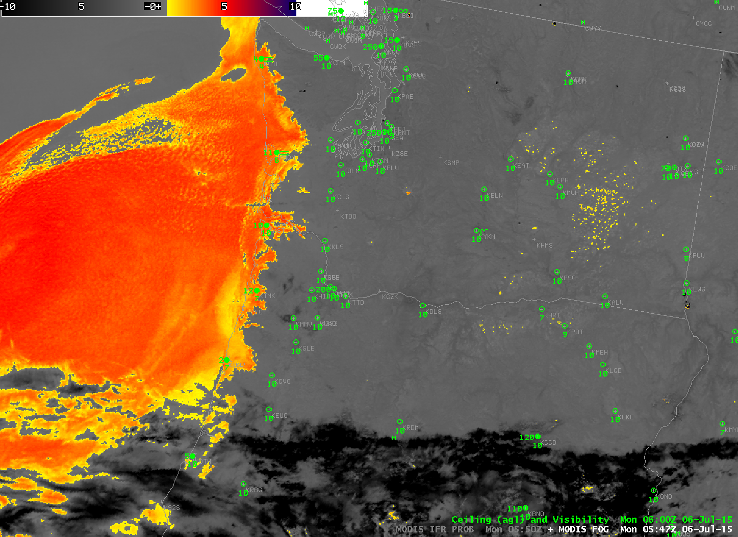
MODIS-based brightness temperature difference fields, ~0550 and ~1000 UTC on 6 July (Click to enlarge)
MODIS-based Brightness Temperature Difference fields, above, from 0547 (Terra) and 0958 (Aqua) detect a large area of marine stratus over the Pacific Ocean that is penetrating inland up river valleys along the coasts of Washington and Oregon. Dark reatures that are consistent with higher clouds are also present over southern Oregon. GOES-R IFR Probability fields can be computed from MODIS data, and those fields (below) show high probabilities along the coast, in regions where IFR or near-IFR conditions are observed. Aspects of the GOES-R IFR Probability field deserve comment. Where high clouds are present in the MODIS data, GOES-R IFR Probabilities are largely controlled by model-based fields that are typically smooth. This is the case over the northwest corner of the IFR Probability field, for example, and also off the southern Oregon coast at ~0550 UTC. The blocky nature of the IFR Probability fields off the central Oregon coast at ~0550 UTC is likely related to model relative humidity fields that show saturation both near the surface and aloft.
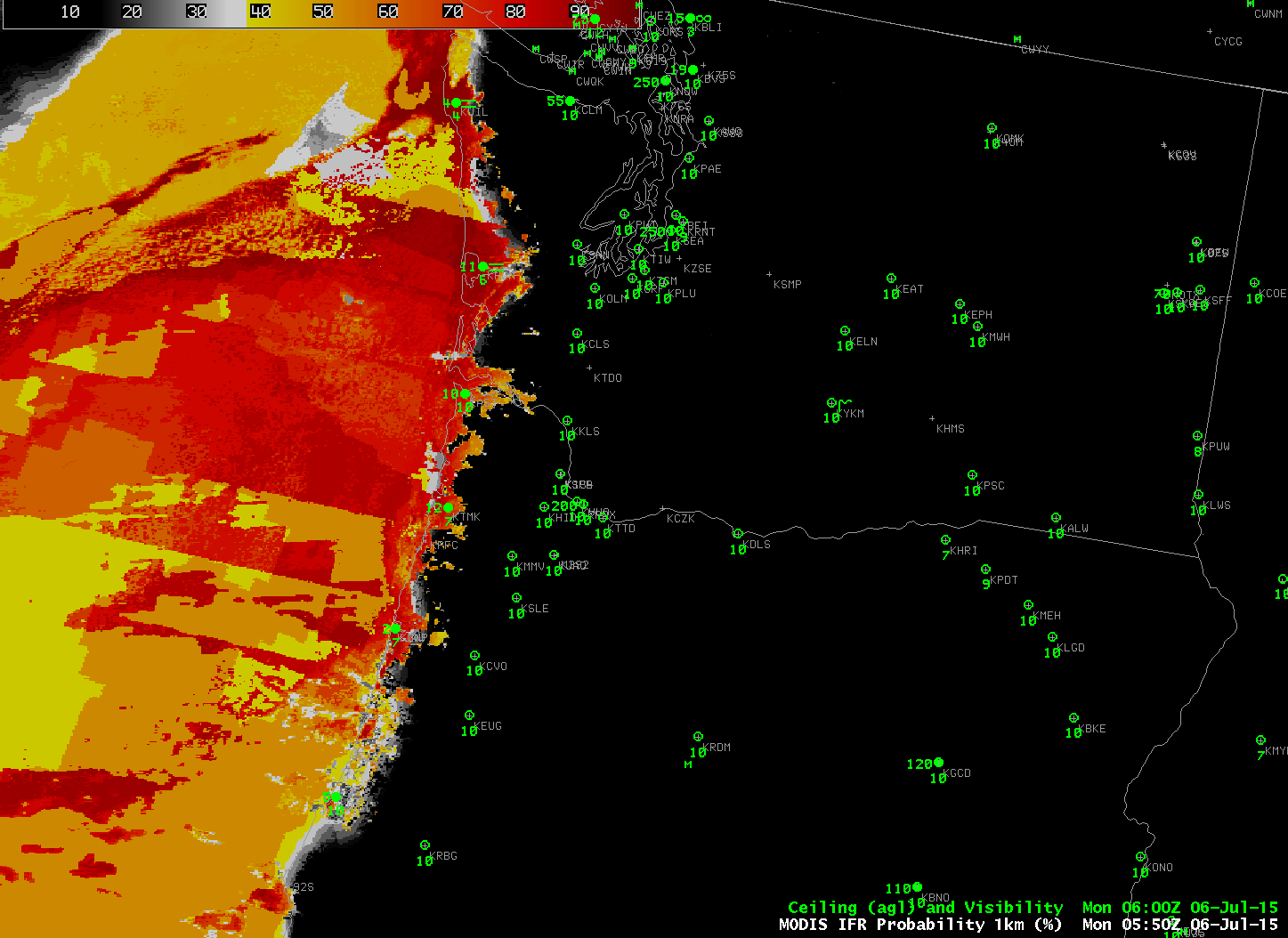
MODIS-based GOES-R IFR Probabilities, ~0550 and ~1000 UTC on 6 July 2015 (Click to enlarge)
Suomi NPP Day Night Band visible imagery had ample illumination early on 6 July with a waning gibbous moon. Imagery below from 1000 UTC (very close to the Aqua pass) also shows thin tendrils of fog moving up river valleys. The VIIRS instrument that provides the Day Night imagery is only on one satellite, however, (compared to MODIS on both Aqua and Terra) so such views are infrequent.
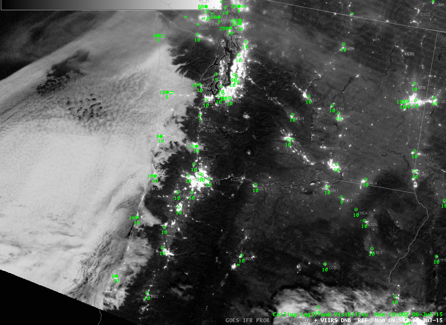
Suomi NPP Day Night Band Visible imagery and Brightness Temperature Difference fields at 0959 UTC, 6 July 2015 (Click to enlarge)
MODIS and Suomi NPP imagery suggest fog is penetrating preferentially into river valleys along the west coast. This should color the interpretation of GOES-based GOES-R IFR Probabilities. GOES-15 lacks the horizontal resolution to resolve fully most river valleys (Rapid Refresh data, similarly, does not resolve small valleys); however, GOES-15 does have excellent temporal resolution, and combining that with the intermittent information from polar orbiters such as Terra, Aqua and Suomi-NPP provides a fuller picture of the evolution of near-surface IFR conditions. The animation of GOES-R IFR Probabilities from GOES-15 is shown below.
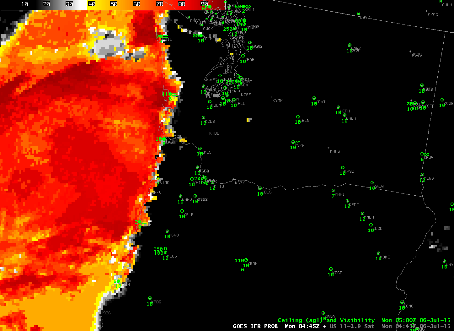
GOES-15 based GOES-R IFR Probabilities, 0445-1345 UTC, 6 July 2015 (Click to enlarge)