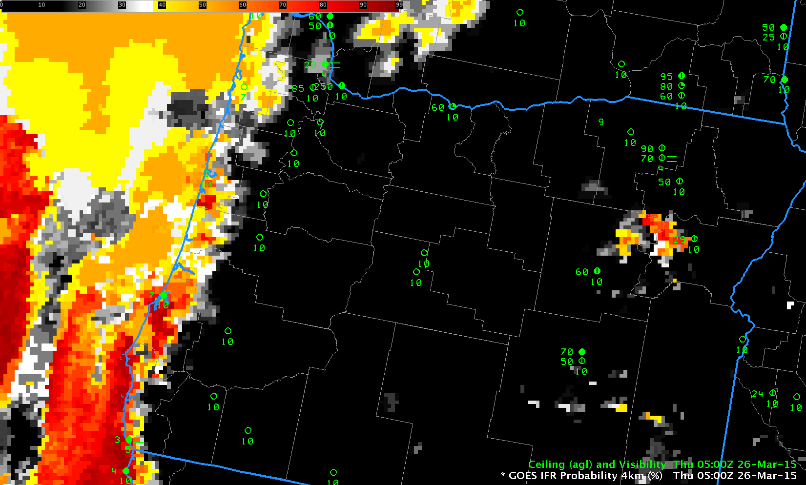
GOES-R IFR Probabilities computed from GOES-15, hourly from 0500 through 1700 UTC, 26 March 2015 (Click to enlarge)
GOES-R IFR Probabilities during the morning of 26 March 2015 expanded eastward from the Pacific Ocean as fog and IFR conditions developed over the western quarter of Oregon. At sunrise, IFR Probabilities dropped along the coast in Northwest Oregon, and IFR conditions were not reported at either Tillamook or Newport, but IFR Probabilities remained high in the Willamette and Umpqua River Valleys, where IFR conditions persisted.
The Brightness Temperature Difference Product, below, for the same time shows a signal in regions where fog/IFR conditions were not reported. The use of model data (Rapid Refresh) in the GOES-R IFR Probability algorithm helps screen out regions where low-level saturation is not occurring — either because the clouds detected by the brightness temperature difference are mid-level, or because the brightness temperature difference field is driven by soil-based emissivity differences at 3.9µm and 10.7µm and not cloudiness at all. The brightness temperature difference signal vanishes near sunrise as solar 3.9µm radiation starts to be reflected off clouds; the sign flips after sunrise and the low clouds appear dark.
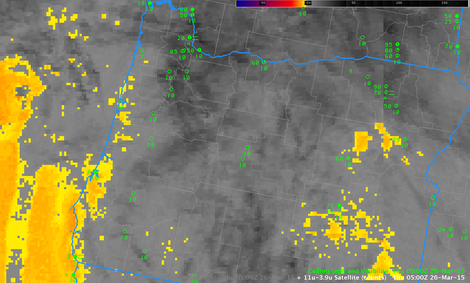
GOES-15 Brightness Temperature Difference (10.7µm – 3.9µm), hourly from 0500 through 1700 UTC, 26 March 2015 (Click to enlarge)
Both IFR Probabilities and Brightness Temperature Difference fields largely miss the isolated IFR conditions over northeast Oregon, around Baker and Meacham.