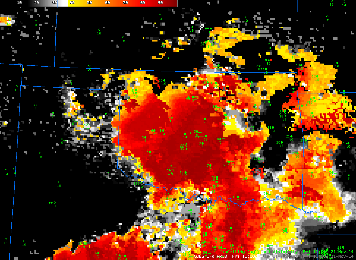
GOES-R IFR Probabilities computed from GOES-East, and GOES-East Brightness Temperature Differences (10.7 µm – 3.9 µm), 1100 UTC on 21 Nov 2014 (Click to enlarge)
The traditional method of detecting fog/low stratus from satellite data, the brightness temperature difference between the longwave and shortwave infrared channels (10.7 µm – 3.9 µm on GOES) can overpredict regions of reduced ceilings and visibilities because satellites see only the top of the cloud. GOES-R IFR Probabilities, in contrast, incorporate surface-based information into a fog/low stratus predictive algorithm. As a result, regions with elevated stratus (such as eastern/northeastern Oklahoma in the toggle above) that should not affect transportation (for example) can be screened out of a field meant to diagnose regions of reduced visibilities.