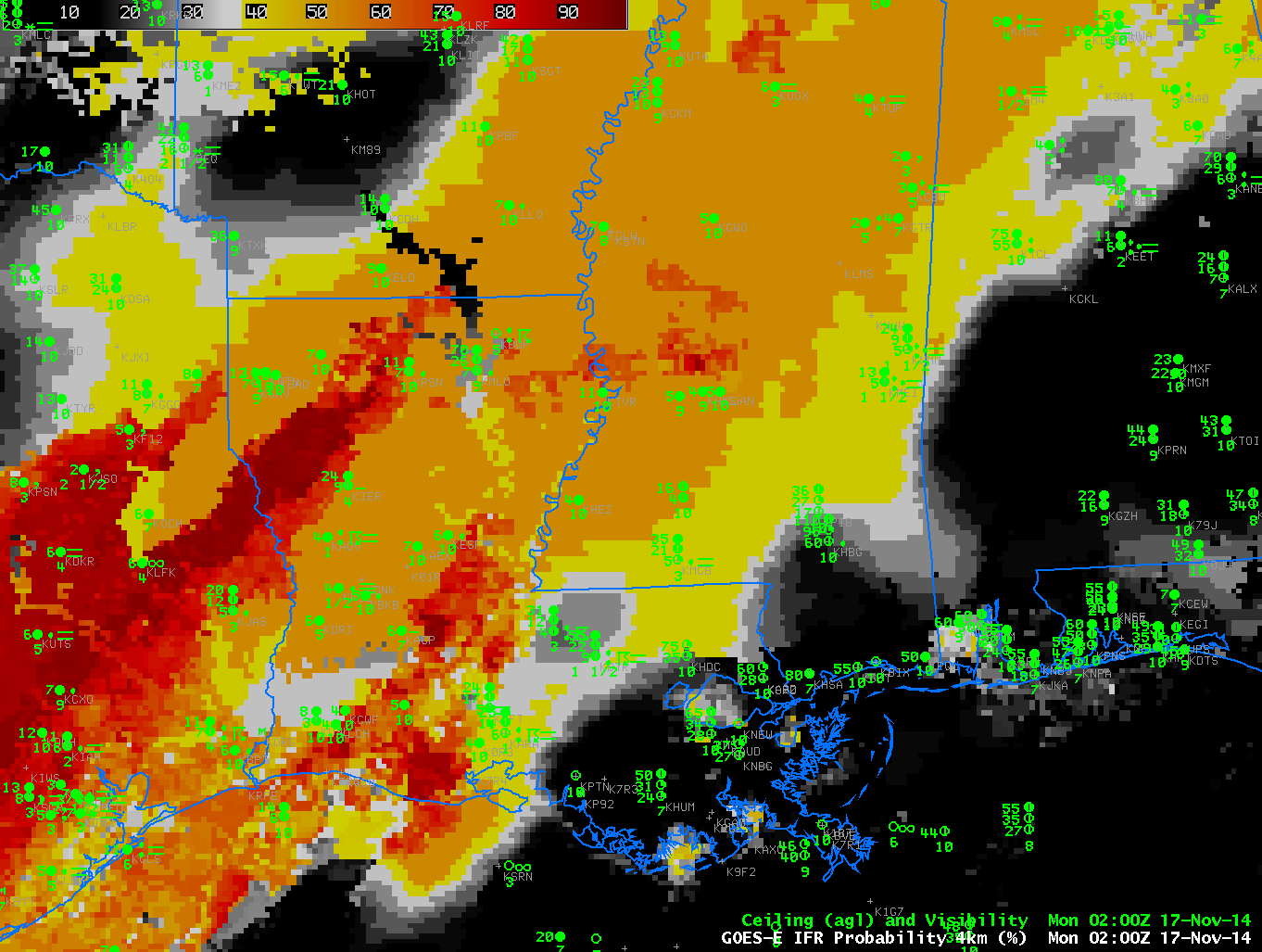
GOES-R IFR Probabilities ~hourly from 0200-1215 UTC on 17 November along with surface plots of ceilings and visibilities (Click to enlarge)
A strong cold front moved through the deep south in the early morning of 17 November 2014, accompanied by low ceilings and reduced visibilities that were very close to IFR conditions. Multiple cloud layers, however, prevented brightness temperature difference fields from diagnosing the low clouds. In cases such as these, a data fusion product such as GOES-R IFR Probability that incorporates surface information via a model simulation (such as the Rapid Refresh) that assimilates surface data is still able to highlight regions where IFR Conditions are most likely. In the animation above, flat fields (those that are horizontally homogeneous, such as over central Mississippi at 0315 UTC) are regions where multiple cloud layers prevent the identification of low cloud features and GOES-R IFR Probability is therefore computed using model-based predictors only. Regions over Louisiana at the beginning of the animation are more pixelated in appearance. This is a region where high clouds have pushed off to the East, where satellites can observe the behavior of low stratus and where satellite data can therefore be used as a predictor in the GOES-R IFR Probability algorithm. Regions where satellite data cannot be used generally have lower probabilities because one of the predictors (satellite data) is absent. That is the case in the above animation. When satellite data can be used, IFR Probabilities increase. Use that knowledge of the behavior of IFR Probability fields to tailor your interpretation of the magnitude of the IFR Probability.