Daily Archives: August 29, 2012

Fog over North Dakota

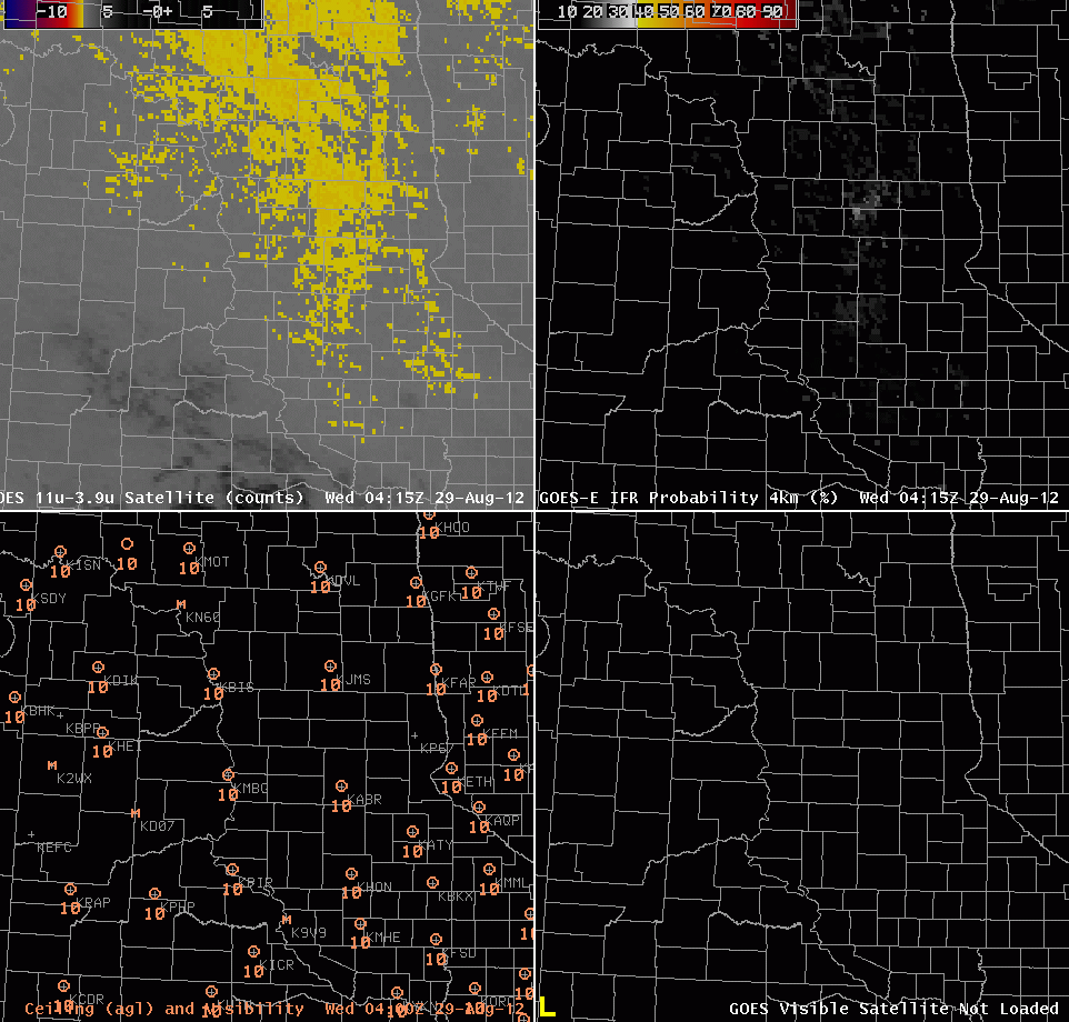
GOES-East brightness temperature difference (Upper left), GOES-R FLS Product (Upper Right), Ceiling and visibility observations (Lower left), Visible Imagery (Lower right)

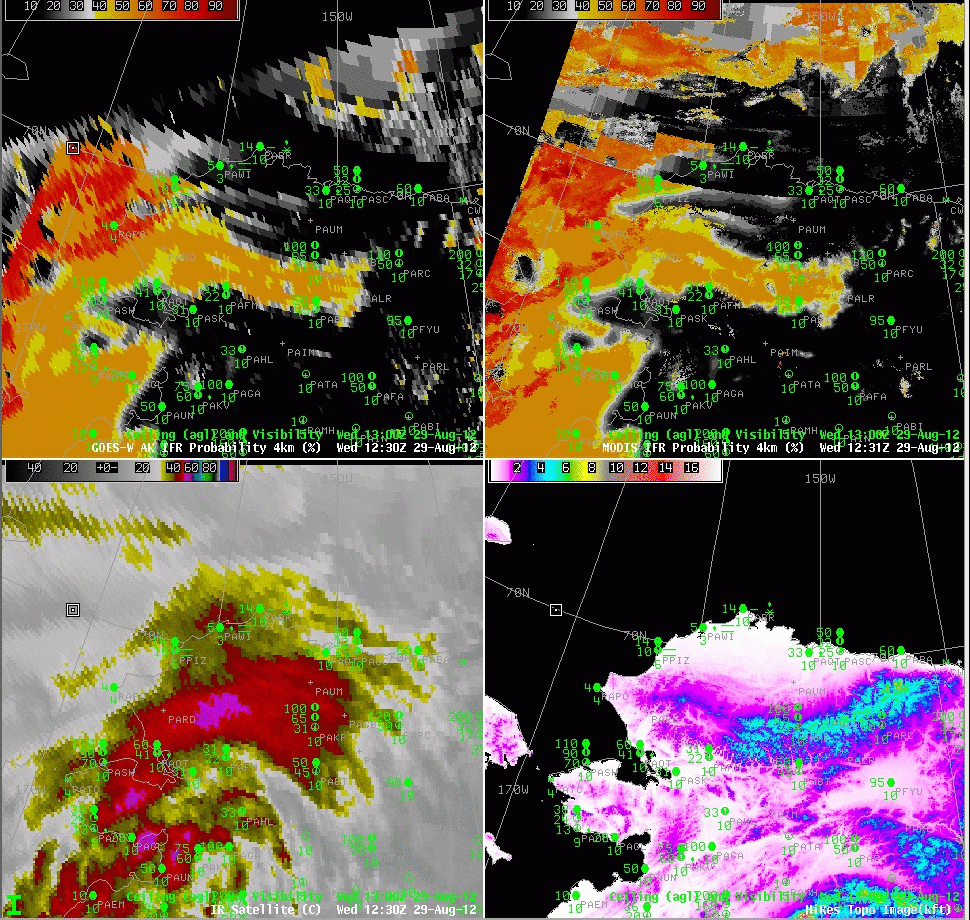
Relatively light winds and high dewpoints promoted the development of isolated fog over the Dakotas on the morning of the 29th.  How did satellite-based and satellite-influenced fog detection algorithms perform?

The Brightness Temperature difference field shows returns suggestive of fog or low stratus in regions over western North Dakota — west of the Missouri River — where IFR conditions are not reported.  The GOES-R FLS product suggests a smaller region of fog and low stratus;  there are high probabilities in regions where IFR conditions occur.  However, there are several examples of IFR conditions that are reported at stations just at the edge of the region of high probabilities:  KMHE at 1115 and 1215 UTC, for example.  The isolated nature of the fog in the visible imagery also is suggetive of a more limited fog event than might have been expected given the Fog/Low stratus probabilities.  Note the abrupt change as daytime predictors replace nighttime predictors.  In this case, it seems as though the daytime predictors better handle the small horizontal scale of the fog event.

The morning sounding from KBIS is characteristic of a fog event in a river valley.

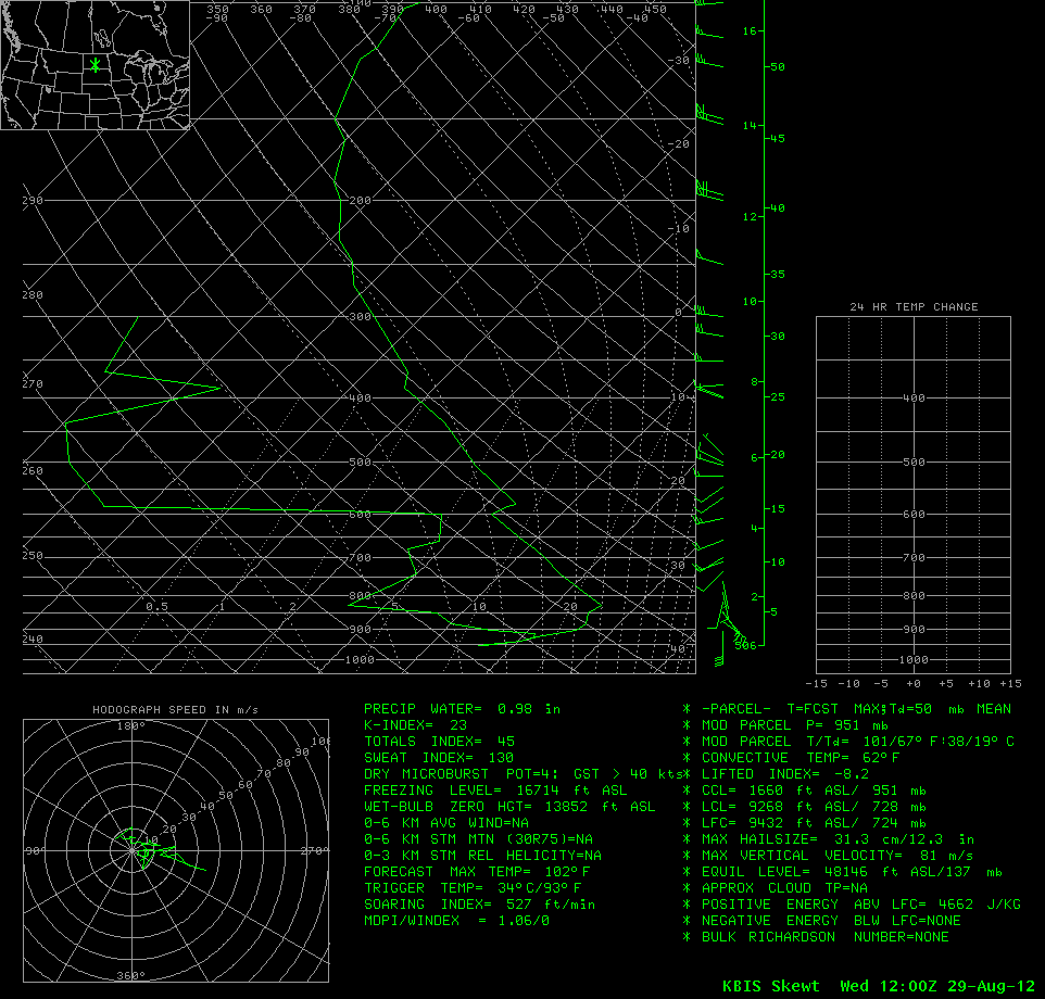
Thermodynamic diagram for KBIS at 1200 UTC on 29 August 2012. Note the saturated layer at the surface.

GOES-R Fog/Low Stratus in Alaska

GOES-R IFR Probabilities from GOES-W (Upper Left) and from MODIS (Upper Right); GOES-W color-enhanced IR Imagery (Bottom Left), Alaska Topography (Bottom Right).  Station Observations including visibilities and ceilings above ground level as indicated.

Alaska poses unique challenges in both Fog/Low stratus detection and in aviation forecasting.  For example, there are very few observation sites — airports — where verification of products can occur.  The abundance of small aircraft — bush aircraft — means that aviation support is critical in remote regions where such aircraft will operate.  Alaska is also far enough north that the GOES-West pixel footprint size is very large, making detection of small-scale fog events difficult.

The series of images above document some of these issues.  The GOES-R IFR Probabilities computed with GOES-West data (upper left) and MODIS data (upper right) show similar patterns.  But the far superior resolution inherent in polar orbiters over Alaska results in far greater detail in the MODIS product.  This is a case with multiple cloud layers over northern Alaska (as evidenced by the 10.7 window channel image, lower left);  the enhanced IFR probabilities along the Brooks Range in northern Alaska are mostly model-driven (the model used in that region is the Rapid Refresh (the boundary between the Rapid Refresh and the GFS is apparent in the upper left image over the Bering Sea and over far northern Alaska).  The model suggests IFR conditions are possible in an elevated stratus cloud that surrounds the Brooks Range.  That is, the terrain is rising up into the clouds.