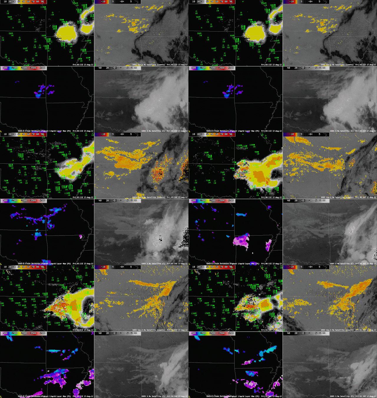
Post-sunset convection can supply the moisture that is needed for the development of overnight fog and low stratus. But do those low clouds cause IFR conditions? This example over NW Arkansas from the morning of 17 August shows GOES-R IFR Probabilities that successfully pinpoint the regions where IFR conditions are most likely and exclude regions where IFR conditions do not occur. The brightness temperature difference field and the 3.9 µm both show convection before 0600 UTC. Subsequent to the convection, a brightness temperature difference signal that is consistent with fog/low stratus does develop over southern Kansas, and then over south-central Missouri and northwest Arkansas. The GOES-R IFR Probabilities, however, suggest that IFR conditions are likely only over northwest Arkansas (where IFR conditions are observed).
This example also ably demonstrates the differences in the character of the IFR Probability field that occur when model data alone are used to predict IFR probabilities (Northeast Arkansas during most of the loop) vs. a combination of Satellite and Model data (Northwest Arkansas at the end of the loop).

