Strong extratropical storms that move northward into the Gulf of Alaska, or into the Bering Sea, can bring IFR conditions to many parts of Alaska. However, they typically also bring multiple cloud layers that make traditional satellite-only methods of detecting fog and low stratus problematic. In cases like these, a fused product that incorporates model predictions of low-level saturation is helpful in defining just where IFR conditions are most likely.
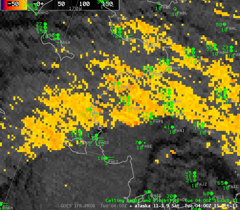
GOES-15 Brightness Temperature Difference Product (10.7 µm – 3.9 µm), times as indicated (click image to enlarge)
For example, the brightness temperature difference field, above, does not show a strong signal in regions where near-IFR conditions are present. In contrast, the IFR Probability field, below, that incorporates model fields that are influenced by surface features, better highlights the region of IFR conditions. It captures the edge of the fog/low stratus field over SW Alaska, and probabilities are highest in regions where IFR and near-IFR conditions exist. The relatively flat field over land is a typical feature of the IFR Probability when it is determined chiefly by model data. Because satellite data are not included in the predictors, the total probability is somewhat smaller. Where the satellite brightness temperature difference field does have a strong signal is where the IFR Probabilities are highest (over the Bering Sea).
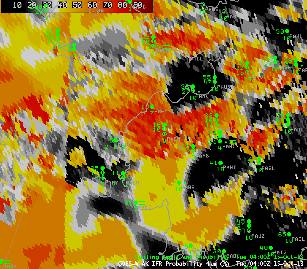
GOES-R IFR Probabilities derived from GOES-15 and Rapid Refresh data Brightness Temperature Difference Product (10.7 µm – 3.9 µm), times as indicated (click image to enlarge)
One shortcoming with IFR Probability is the pixel resolution at high latitudes. MODIS data can also be used to compute IFR Probabilities, and three comparisons between MODIS and GOES values are shown below. Alaska’s high latitudes means not only large GOES pixels, but also fairly frequent coverage from the polar-orbiting Terra and Aqua satellites that hold the MODIS instrument.
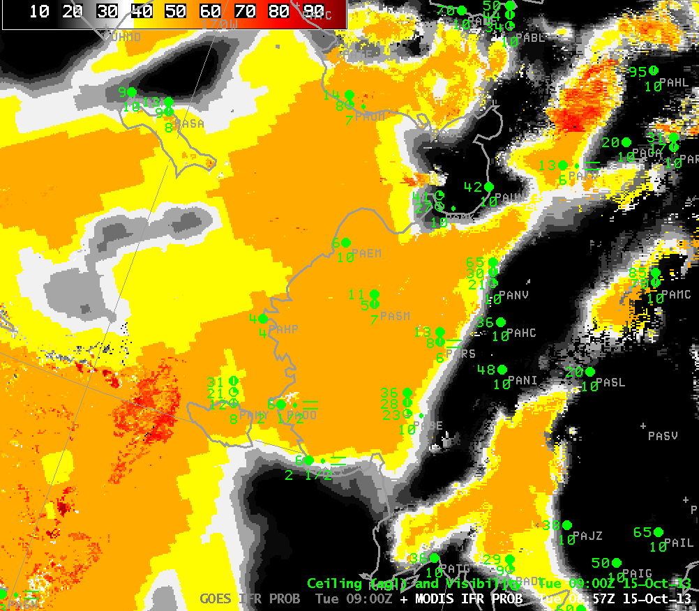
Toggle between GOES-R IFR Probabilities derived from GOES-15 and from MODIS satellite data at ~0900 UTC 15 October (click image to enlarge)
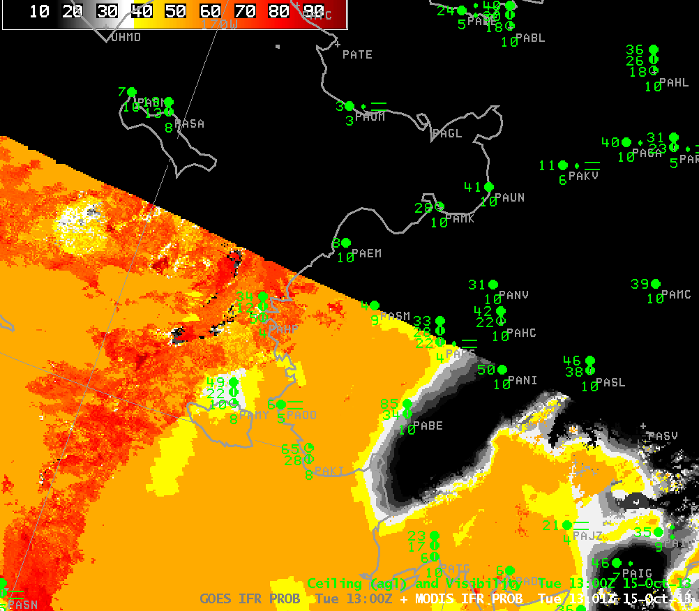
As above, but at ~1300 UTC (click image to enlarge)
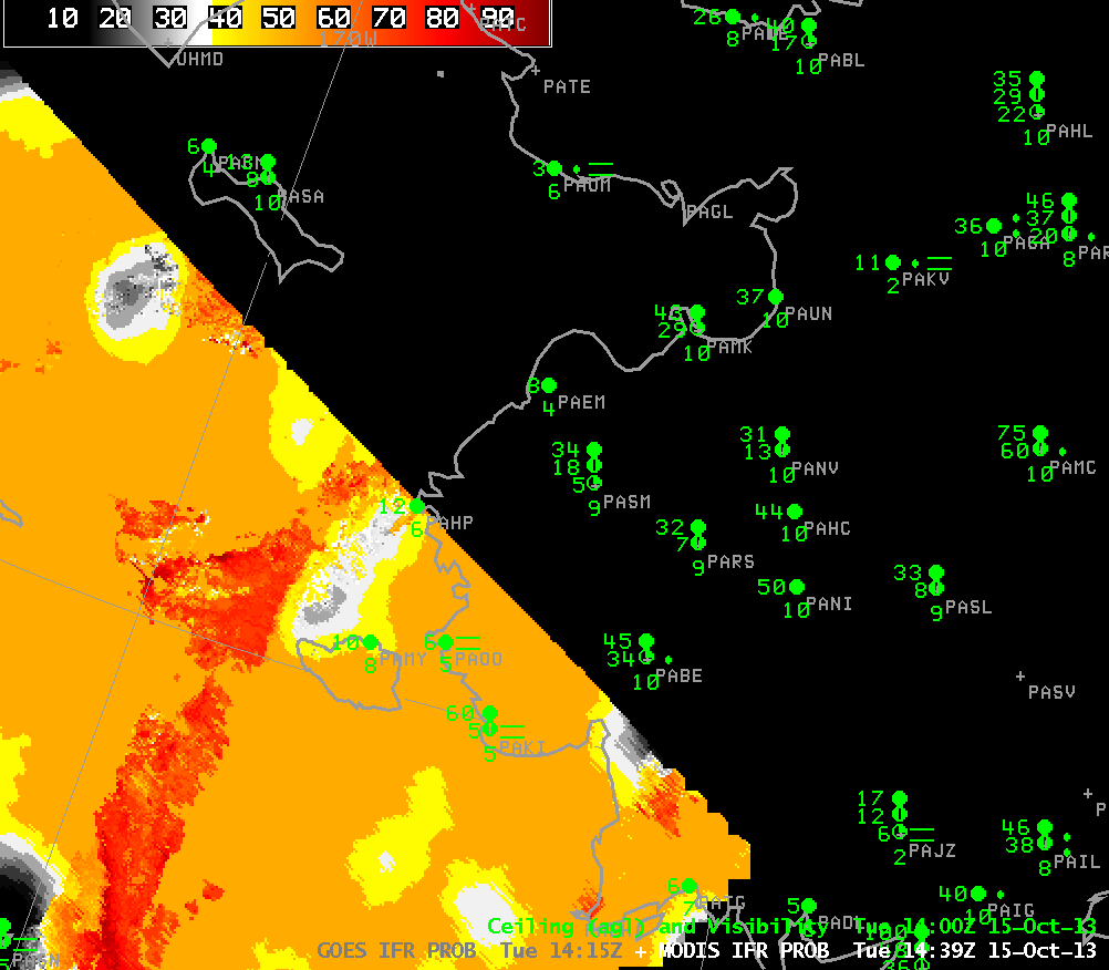
As above, but at ~1430 UTC (click image to enlarge)