 |
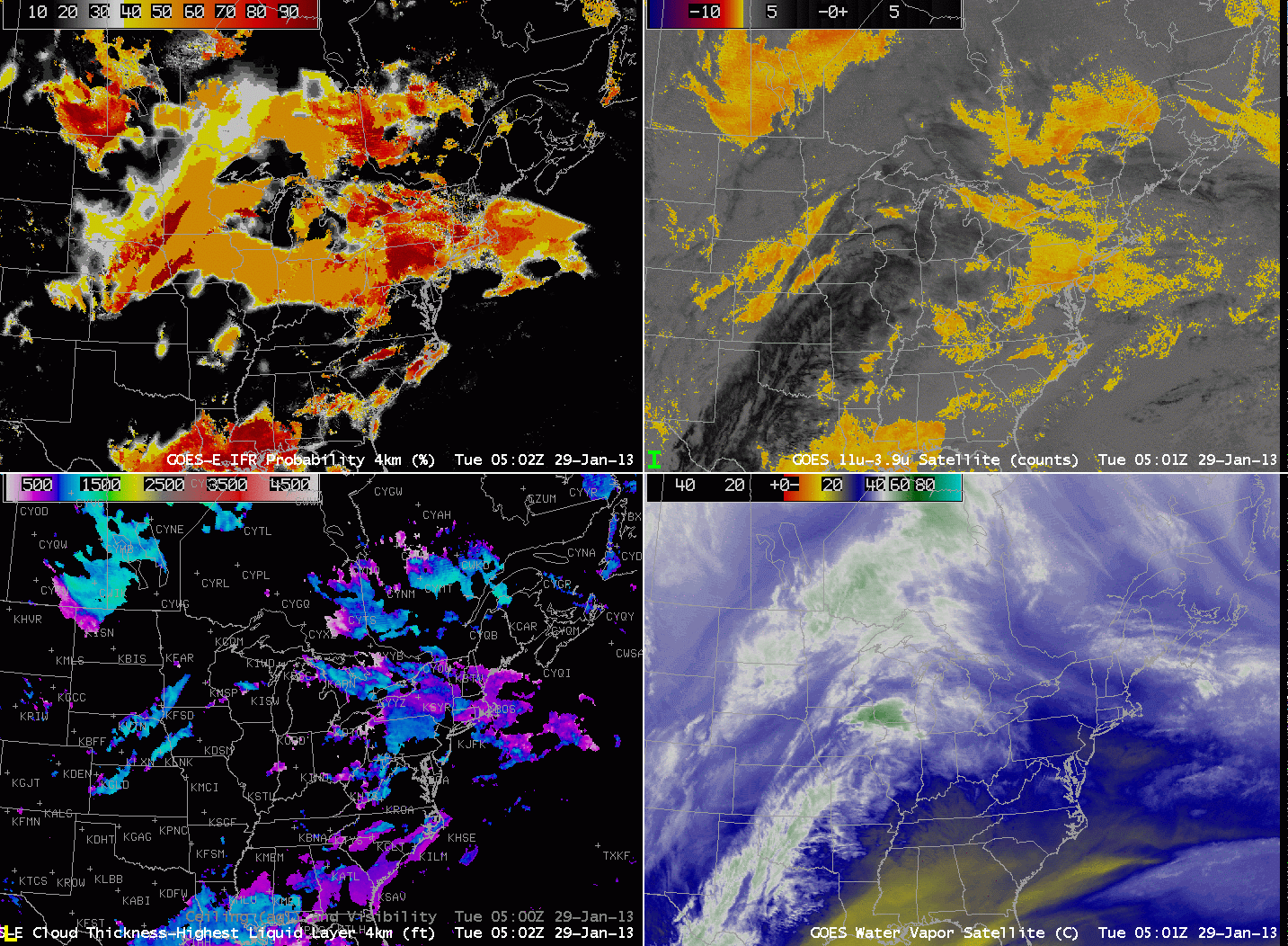
| GOES-R IFR Probabilities computed from GOES-East (Upper Left), GOES-East Brightness Temperature Difference (10.7 µm – 3.9 µm) (Upper Right), GOES-R Cloud Thickness of highest liquid water layer (Lower Left), GOES-East Water Vapor (6.7 µm) (Lower Right) |
It’s very common in late Winter and early Spring to have a cirrus shield over a region of dense advection fog. The water vapor imagery, above, shows the cirrus associated with a developing warm conveyor belt over the central part of the USA. Note how the cirrus signal also shows up in the brightness temperature difference field, and the emissivity properties of ice clouds differ strongly from those of water-based clouds (that in the enhancement in the upper right are orange versus black for ice clouds). The presence of cirrus also precludes computation of GOES-R cloud thickness, as shown in the lower left imagery.
GOES-R IFR probabilities allow for the identification of regions of low clouds/fog even underneath the high clouds. Note over Michigan the relatively high probabilities. The probabilities are generated using only model-based predictors (because the satellite algorithm sees only the high clouds so satellite predictors are very small or missing). The 1000 and 1300 UTC imagery, below, shows widespread IFR conditions underneath cirrus over Michigan and surrounding states. IFR conditions are generally present in regions where the IFR probabilities are high. Ceilings/visibilities do not meet IFR criteria over Western Illinois where IFR Probabilities are much lower.
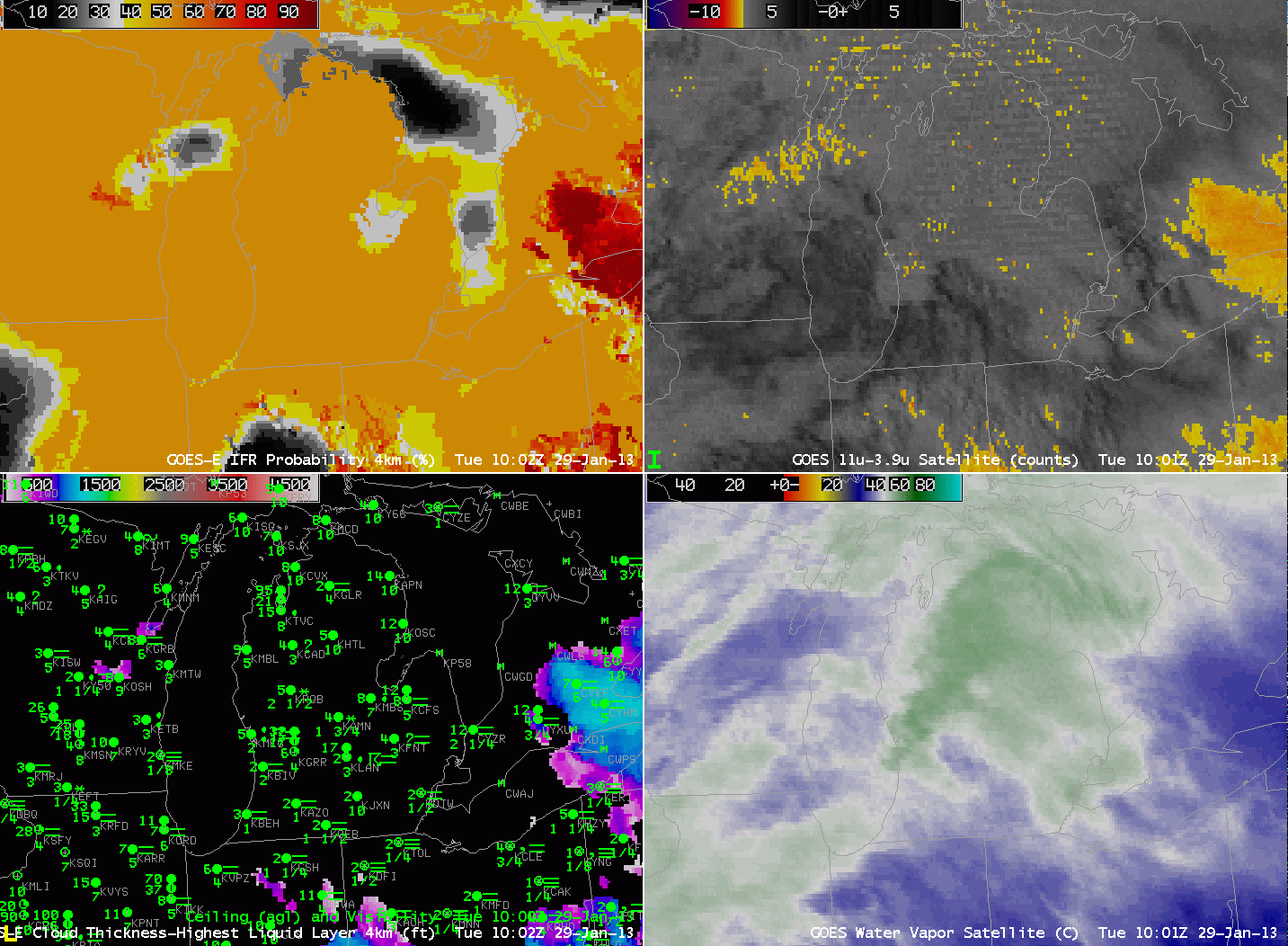 |
| As above, but centered over Michigan |