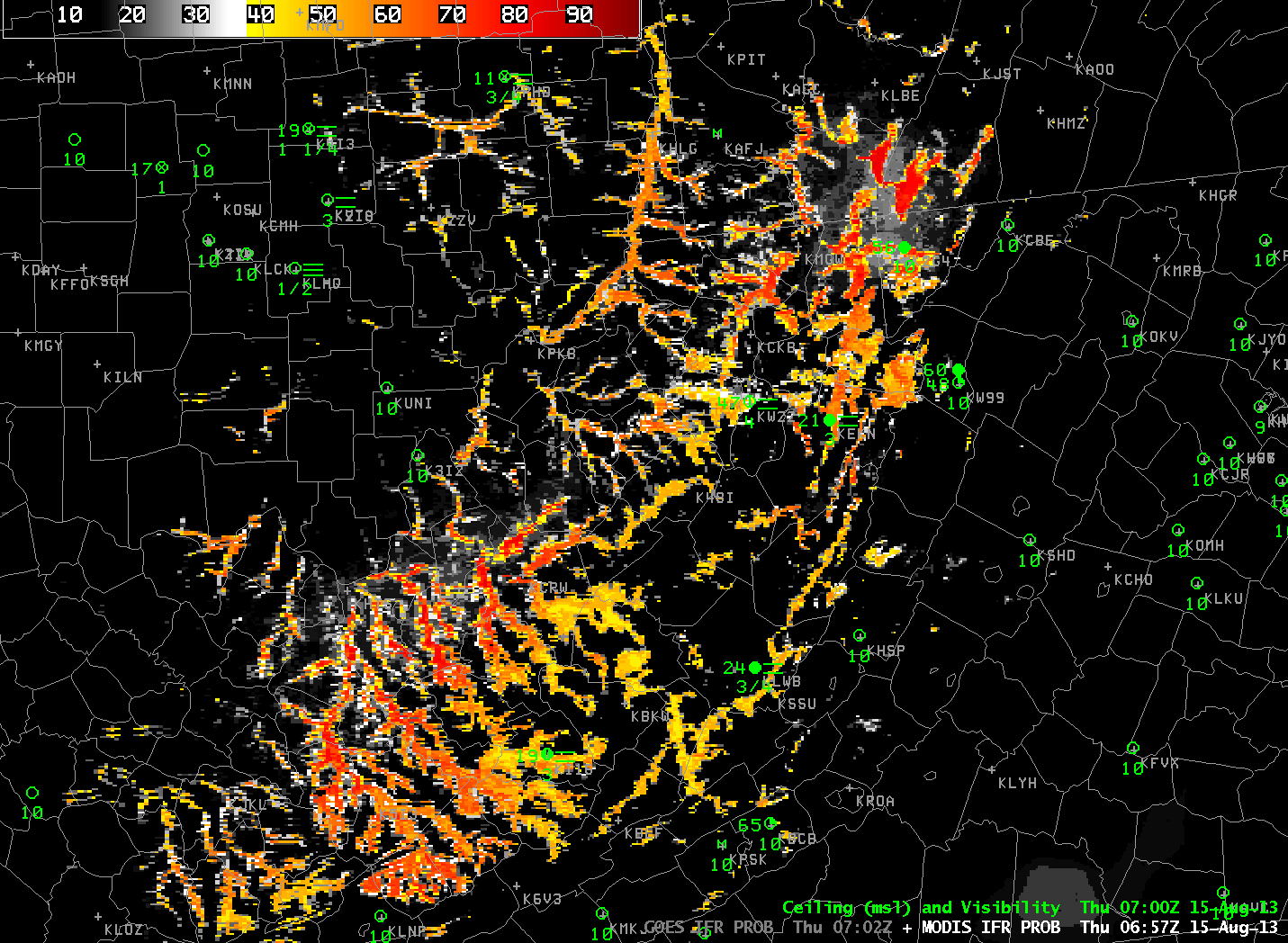
MODIS-based IFR Probabilities and Cloud Thickness, 0657 UTC on 15 August 2013
The 1-km data available from the MODIS (above) that is on the Terra and Aqua satellites allows much better resolution than the nominal 4-km resolution from GOES-East and GOES-West (below). The higher resolution on MODIS yields better depiction of dendritic valley fog patterns in mountainous regions. Extremes in cloud thickness will be deeper with MODIS data as well. (In this example, MODIS-based cloud depths reach 1300 feet, vs. 900 feet in GOES) In addition, because fog/low stratus generally starts at small scales and grows in size, MODIS is more likely to detect the early stages of fog (if a serendipitous overpass occurs). Thus, a forecaster can be alert to subsequent development in the GOES data with its better temporal resolution.
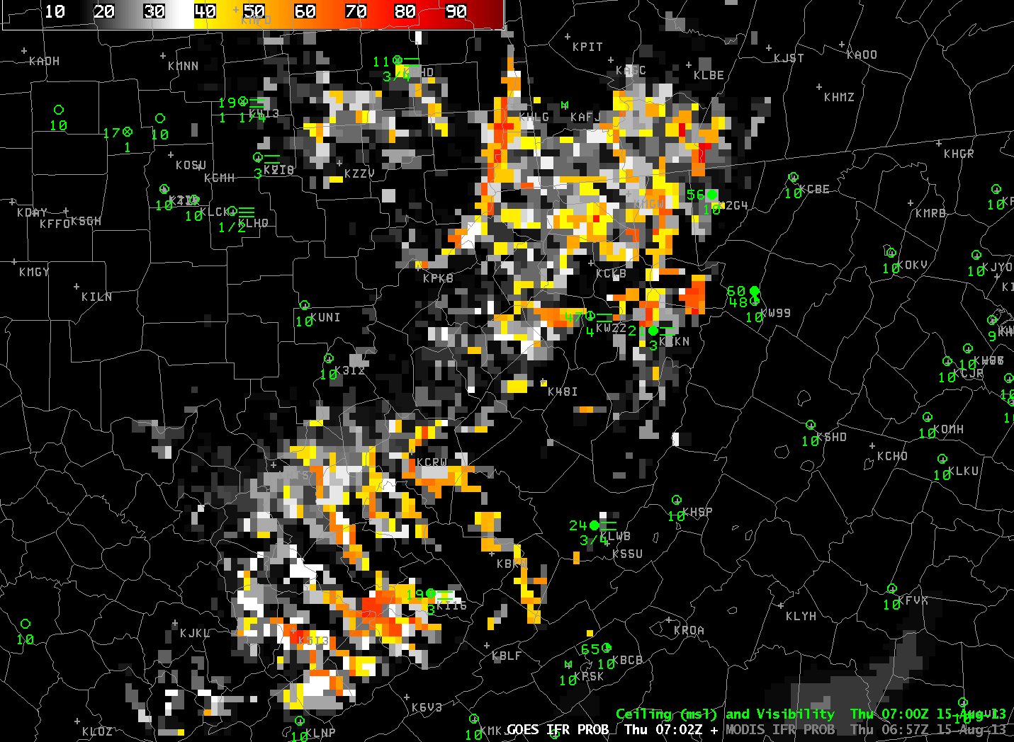
GOES-based IFR Probabilities and Cloud Thickness, 0702 UTC on 15 August 2013