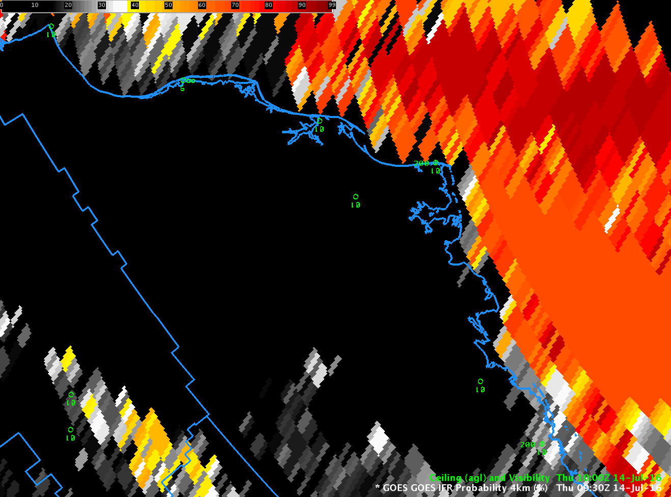
GOES-R IFR Probability Fields, 0930-1230 UTC on 14 July 2016 (Click to enlarge)
The low Sun Angle at very high latitudes during Summer presents a challenge to the GOES-R IFR Probability algorithm. Solar backscatter from clouds in the visible and near-infrared (3.9 µm) channels make traditional fog detection methods (Brightness Temperature Difference between 10.7 µm and 3.9 µm) problematic, but they also are a challenge for GOES-R IFR Probability. At mid-latitudes, when 3.9 µm radiation is changing quickly because of rapid changes associated with a rising (or setting) sun, the ‘satellite’ portion of GOES-R IFR Probability will be frozen for a time step or two. In the GOES-R Algorithm, temporal data (in other words, data from previous times) are used starting at the beginning of the terminator transition periods (that is, when the sun is rising or setting) and it’s used until valid data, either day or night predictors, depending on whether it’s sunrise or sunset, is again available. At mid-latitudes (as seen in the example at the bottom of this post), the transition period is typically less than thirty minutes in length. At high latitudes, however, when the sun lingers near the horizon for hours, the use of temporal data can stretch out for several hours and products will not be updated during that time. This effect happens only in the months surrounding the Summer solstice.
Consider the animation above, of GOES-R IFR Probability north of Alaska, over the Arctic Ocean. IFR Probabilty varies with each time step over much of the image, especially, for example, near the lower left corner (a region that includes the Brooks Range). There is a significant region, though, where values do not change over the three hours of the animation — this is because of the low sun angle and the difficulty in relating the 3.9 µm emissivity to a fog property. (You can detect at the end of the animation changes starting to impinge on the region of a static signal from the west) The three hour animation from 1100-1400 UTC, below, shows changes in the field over much of the domain over the Arctic Ocean.
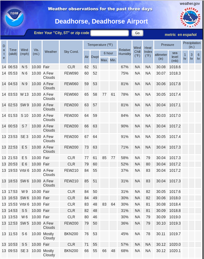
Barrow Alaska (PABR) develops IFR conditions during this animation as low clouds move south from the ocean. GOES-R IFR Probability fields suggest that the fog does not penetrate far inland. Much of northern Alaska had record high temperatures on 13 July (It was 85 in Deadhorse, for example) with light south/southwest winds that would keep the ocean stratus offshore. Webcam views at Barrow (from this link) confirm the presence of IFR conditions.
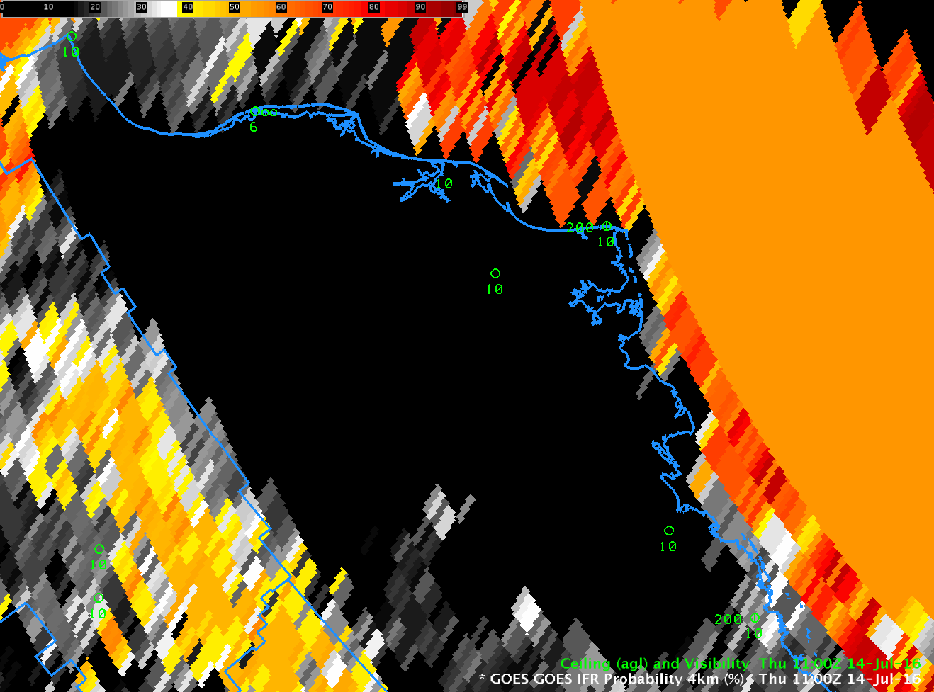
GOES-R IFR Probability fields, 1100-1400 UTC on 14 July 2016 (Click to enlarge)
When GOES-R is flying, data the 8.4 µm channel will be incorporated into the GOES-R IFR Probability algorithm. This channel (Band 11 on the GOES-R ABI) is not so adversely affected by reflected solar radiation as the 3.9 µm channel so the unchanging nature of GOES-R IFR probability fields will be mitigated.
This stationarity in the GOES-R IFR Probability is apparent at mid-latitudes as well. Careful inspection of the animation below, from 1300-1400 UTC on 14 July 2016, shows a region of static IFR Probability fields off the coast of northern Oregon between 1315 and 1345 UTC.
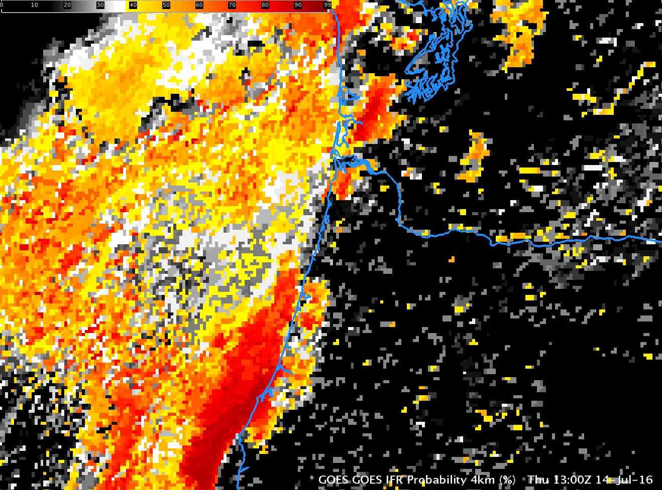
GOES-R IFR Probability, 1300-1400 UTC on 14 July 2016 (Click to enlarge)