The approach of an extratropical cyclone, such as the Colorado Cyclone in this animation in the upper Midwest on 10 September 2014, will frequently result in areas of IFR or near-IFR conditions. However, the many cloud layers that accompany these baroclinic disturbances will always make difficult the task of identifying (using satellite imagery) regions of low stratus and fog. Consider the animation below of Brightness Temperature Difference (10.7µm – 3.9µm) fields (a traditional method of detecting water-based clouds) over the Upper Midwest on 10 September.
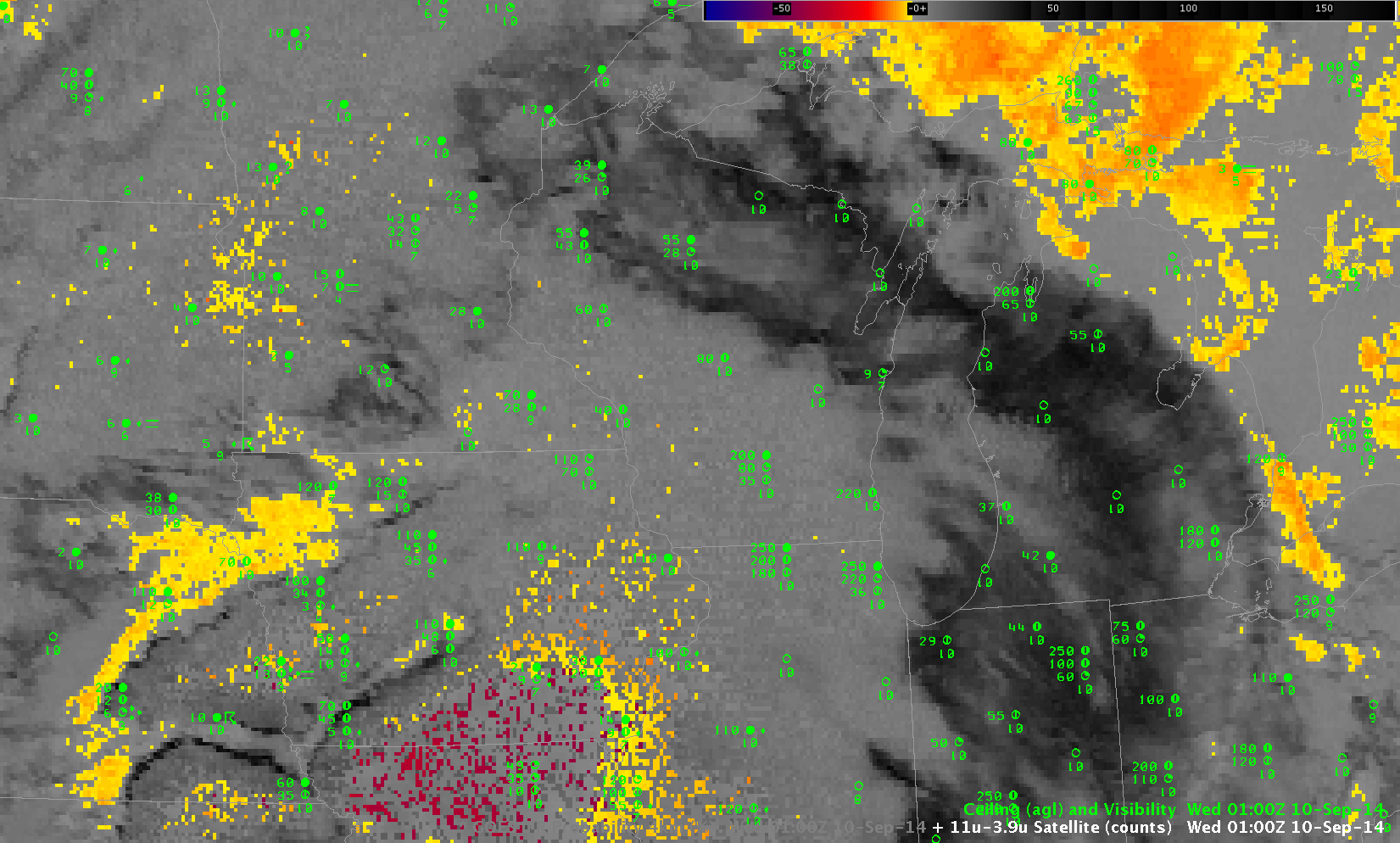
Color-enhanced Brightness Temperature Difference fields (10.7µm – 3.9µm), hourly from 0100 UTC to 1400 UTC on 10 September 2014 (Click to enlarge)
Interpretation of this loop is time-consuming. Not only is there little distinct signal related to observed IFR and near-IFR conditions, but the rising sun (at the end of the animation) causes the Brightness Temperature Difference to flip sign, altering the enhancement. There are regions where the Brightness Temperature Difference field detects water-based clouds that may be associated with fog or stratus, chiefly over the western third of the domain (and especially over the Dakotas) in the later half of the animation.
Compare the animation above to the loop of IFR Probabilities for the same time period below. IFR Probabilities are highest where near-IFR or IFR conditions are present, and the IFR Probability field screens out regions where low stratus (but not fog) is present, such as over the Dakotas at the end of the animation. Regions where IFR Probability fields have a flat character — such as over Wisconsin around sunrise — are where only Rapid Refresh model data (but not satellite data) are used as predictors, and the field does not have pixel-scale variability. Because fewer predictors are used, the magnitude of the IFR Probability is smaller than in regions where both satellite and model data can be used as Predictors. Thus, a flat field (over eastern Wisconsin at the end of the animation, or over Iowa at the beginning) has values that should be interpreted differently from similar values in regions where both satellite and model data can be used in the computation of IFR Probabilities.
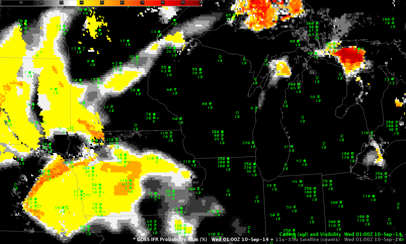
GOES-R IFR Probability fields (Computed from GOES-13 and Rapid Refresh Data), hourly from 0100 UTC to 1400 UTC on 10 September 2014 (Click to enlarge)