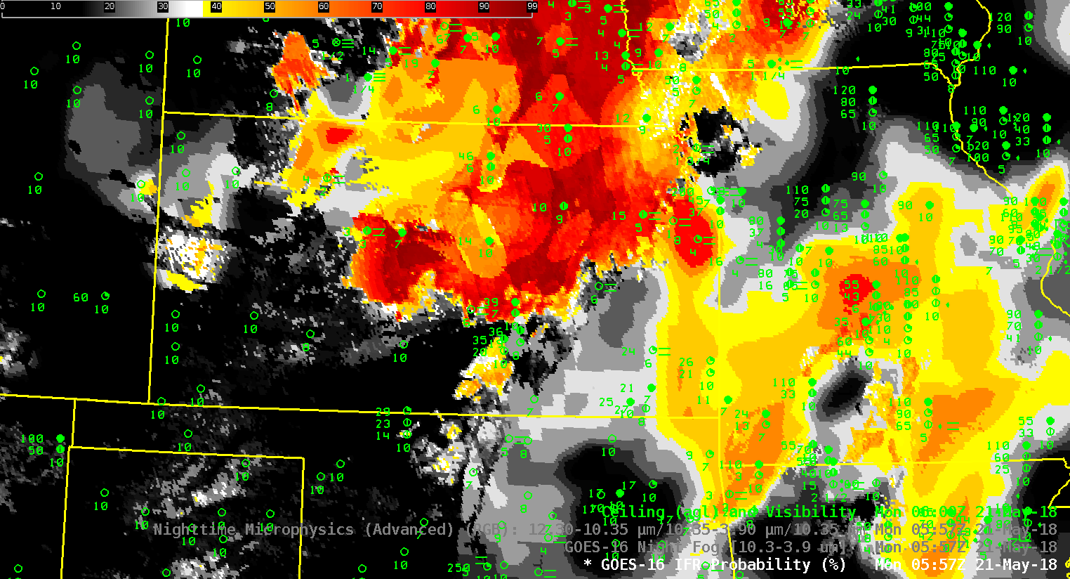
Dense Fog Advisories were issued over Kansas by the Goodland KS Forecast Office on Monday 21 May 2018. The IFR Probability field, above, computed using GOES-16 and Rapid Refresh Model output shows the development of fog as it developed westward across Kansas. (Surface winds in the region were light (source); Plot 2 (from here)).
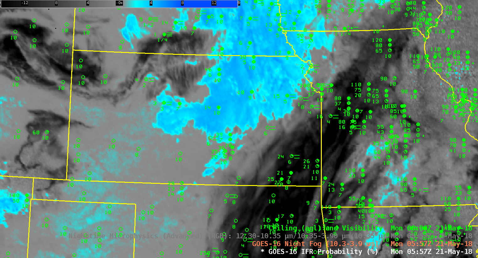
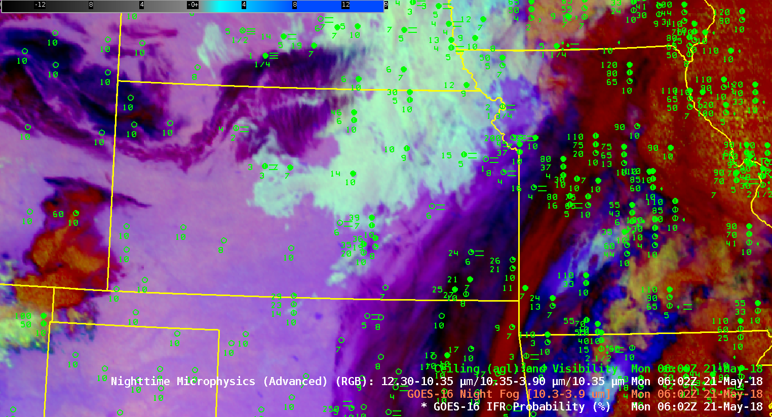
High clouds around Kansas impeded the detection of low stratus/fog from satellite in some regions. Those regions benefit from the fused data methods of IFR Probability: where satellite data alone cannot be used, model data can give important information. Consider the ‘Night Fog’ Brightness Temperature Difference field, below (10.3 µm – 3.9 µm) for the same period as shown above. High clouds are apparent over southeast Kansas and Missouri, and also occasionally over Nebraska. High clouds over McCook, Nebraska, just north of the Kansas-Nebraska state line in southwest Nebraska, prevent the satellite detection of fog even as the ceilings and visibilities decrease. (Here is a toggle of the three products at 1002 UTC).
Similarly, IFR or near IFR conditions develop over southwestern Missouri, but a cirrus shield there means that Brightness Temperature Difference (10.3 µm – 3.9 µm) fields, and the Nighttime Microphysics RGB (that relies on the Brightness Temperature Difference field) cannot observe the low clouds.

GOES-16 ‘Night Fog’ Brightness Temperature Difference (10.3 µm – 3.9 µm), 0557 – 1157 UTC on 21 May 2018 (Click to animate)
When you use a product to ascertain the presence of fog/low stratus, be certain that you understand its limitations.


