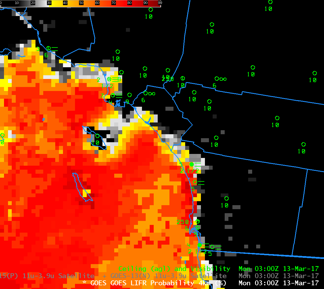
GOES-R IFR Probability, hourly from 0300 to 1300 UTC, 13 March 2017 (Click to enlarge)
Note: GOES-R FLS products are currently derived from GOES-13 and GOES-15 data. A GOES-16 version of the GOES-R FLS products will not be available until later in 2017.
IFR Conditions developed early on March 13th 2017 as Marine Stratus moved over the southern California. This is a typical occurrence that nevertheless requires timely monitoring because of the impact of fog on transportation. The Brightness Temperature Difference fields, below, show the tops of the clouds. Water clouds do not emit 3.9 µm radiation as a blackbody, but they do emit 10.7 µm radiation nearly as a blackbody. Result: Inferred brightness temperatures (a computation that assumes blackbody emission from the source) are cooler and 3.9 µm than at 10.7 µm, and a difference field will highlight clouds made up of water droplets, i.e., stratus. If the stratus is at the surface, fog is a result. Low IFR Probability fields, above, include surface information in the form of low-level relative humidity fields from the Rapid Refresh model. Only where saturation near the surface is indicated by the model will Low IFR Probabilities be large.
In the animation above, IFR conditions develop along the coast and penetrate inland as Low IFR Probabilities increase. Probabilities are decreasing by 1300 UTC.
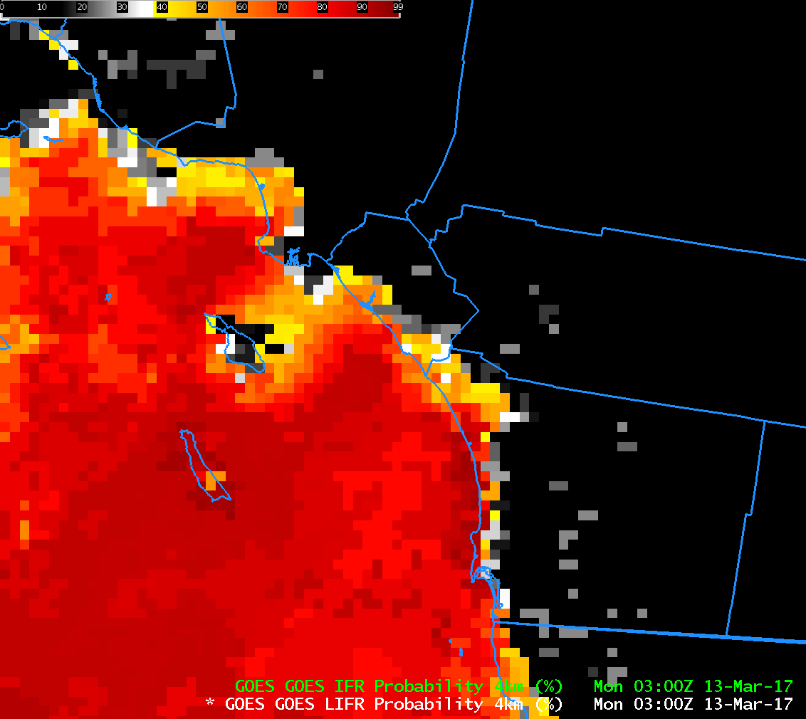
IFR and Low IFR Conditions are shown in this plot from the Aviation Weather Center. This toggle, from 0300 UTC, shows both Low IFR Probability and IFR Probability. As might be expected, IFR Probabilities exceed Low IFR Probabilities
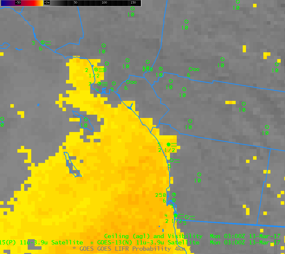
GOES-15 Brightness Temperature Difference (3.9 µm – 10.7 µm) Fields, hourly from 0300 to 1300 UTC on 13 March 2017 (Click to enlarge)