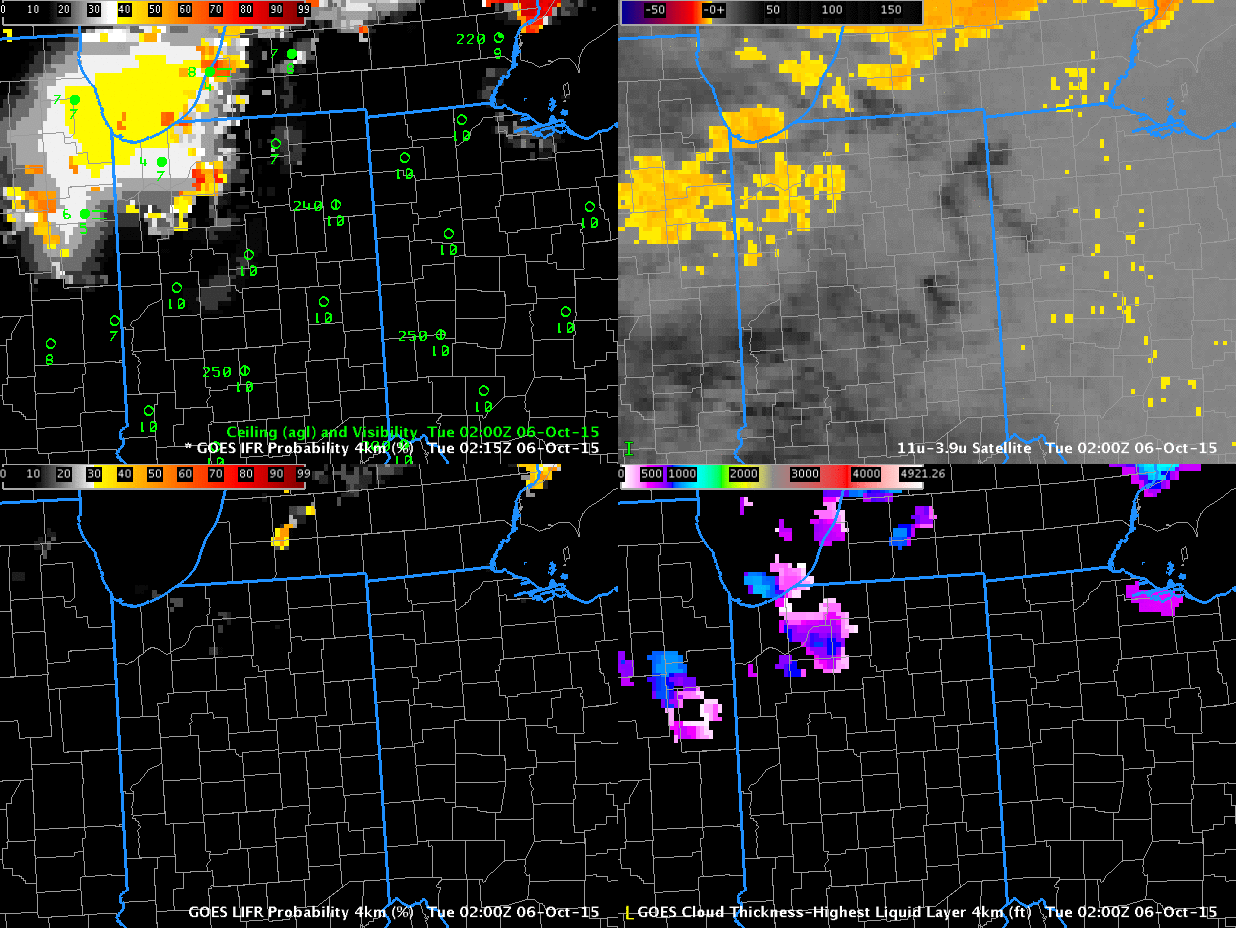
GOES-R IFR Probability (Upper Left), GOES-R Low IFR Probability (Lower Left), GOES-13 Brightness Temperature Difference (10.7µm – 3.9µm) (Upper Right), GOES-R Cloud Thickness (Lower Right) (Click to enlarge)
Fog developed over Indiana and surrouding states (again) on the morning of 6 October, and the animation above traces that development as diagnosed by GOES-R IFR Probability fields. Multiple cloud layers over the region meant that the Brightness Temperature Difference field, a traditional method of low cloud detection (that keys on the differences in emissivity at 10.7 and 3.9 in water-based clouds) could not be used because low cloud detection was hampered by the presence of high clouds. The fused product, GOES-R IFR Probability, provides useful information by combining Rapid Refresh Data information about low-level saturation with satellite fields. When satellite information about low clouds are missing, as in this case, model data provides a signal.
Because multiple cloud layers exist, the GOES-R Cloud Thickness Product (that diagnoses the depth of the lowest water-based cloud based on an empirical relationship between 3.9 µm emissivity and cloud depth developed using sodar observations off the West Coast of the United States) is not produced over much of the region. It is also not produced at times of twilight — such as those that occur at the end of the animation. There are values over southeastern lower Michigan at the start of the animation, where high clouds were not present.
Low IFR Probability is also shown in the animation above (Lower Left figures). The small values in this case suggest any fog is unlikely to be producing visibilities less than 1 mile or ceilings less than 500 feet.