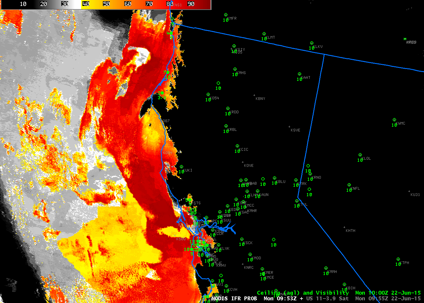
GOES-R IFR Probabilities computed from MODIS data and from GOES-15 data, ~1000 UTC on 22 June 2015 (Click to enlarge)
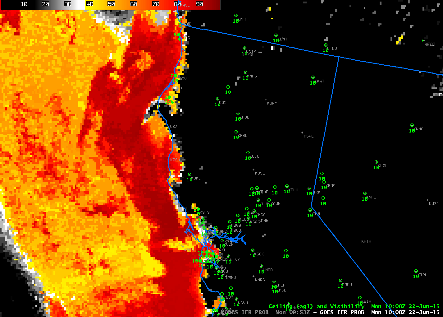
GOES-R IFR Probability was created with an eye towards using data from GOES-R (currently scheduled for launch at the end of March 2016). GOES-R will have better spatial, temporal and spectral resolution than the present GOES. A benefit of better spatial resolution is shown in the toggle above between present GOES (nominal 4-km resolution — vs. the nominal 2-km resolution that will be on GOES-R) and MODIS (1-km resolution). The small valleys along the northern California coastline are far better resolved. The fog/low clouds over San Francisco bay is also better resolved (and the same could be said for the Salinas Valley, south of Monterey Bay if this scene were shifted slightly south). (You might notice a slight 1-pixel shift between MODIS and GOES-15 IFR Probabilities. GOES-15 navigation is compromised by the lack of star-tracking data, so MODIS data are probably better navigated.)
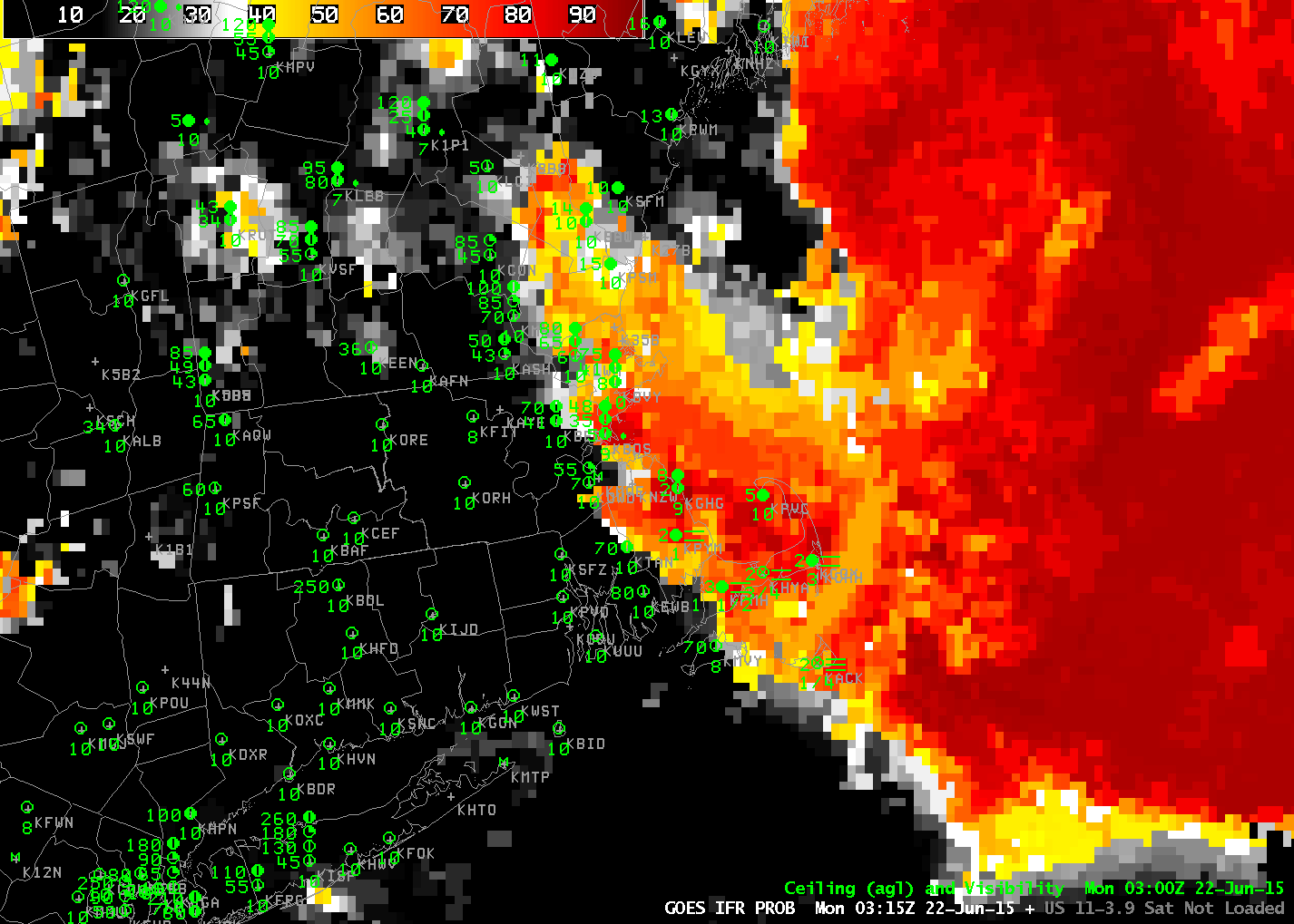
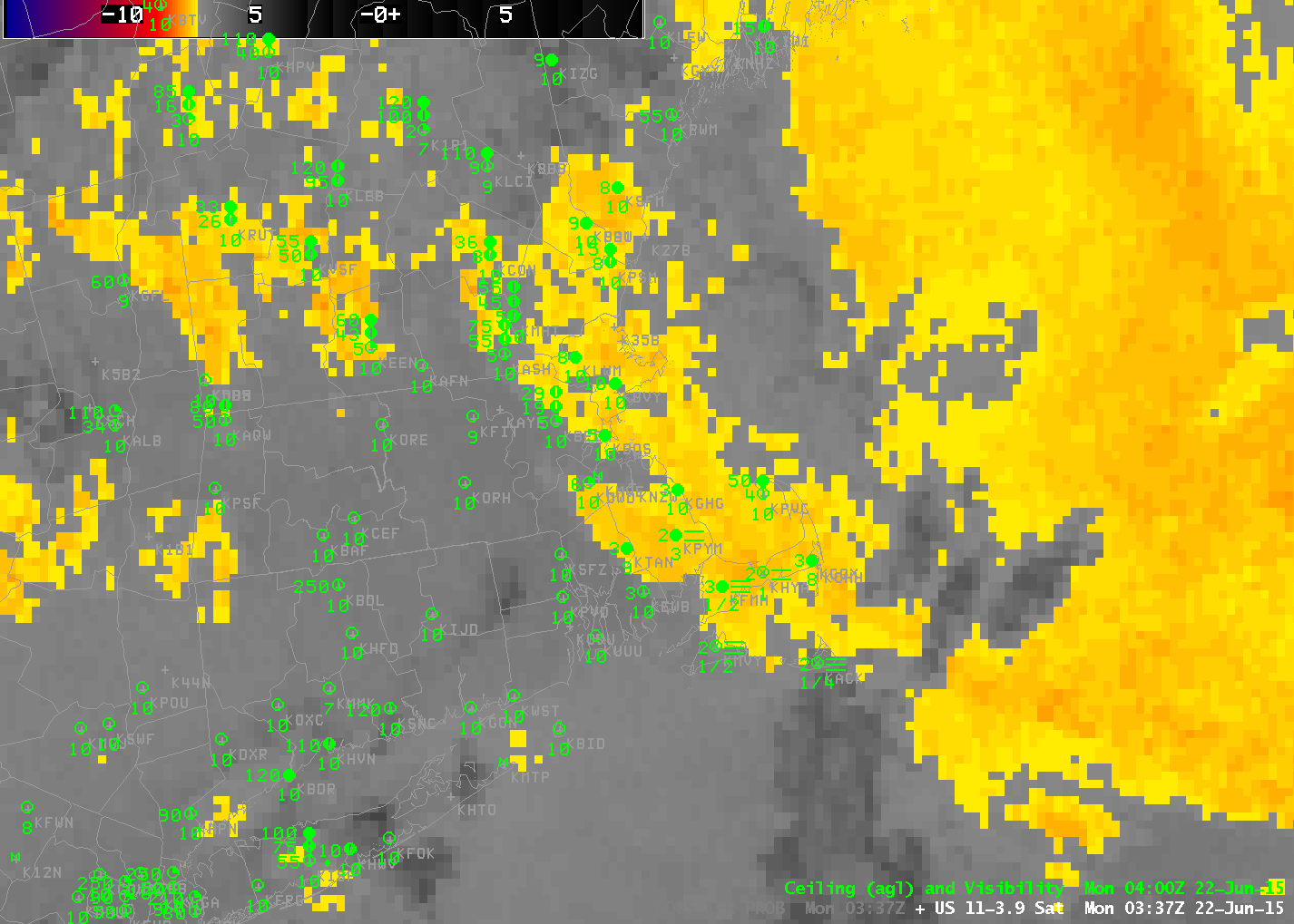
GOES-15 Brightness Temperature Difference (10.7 µm – 3.9 µm) and GOES-R IFR Probabilities, 1000 UTC on 22 June 2015 (Click to enlarge)
IFR Probabilities are derived from GOES-15 brightness temperature difference fields, and a benefit of the IFR Probabilities is obvious above. Brightness Temperature Differences can be driven by emissivity differences in soil. These false positives over Nevada (from the point of view of fog detection) are easily removed if the Model Data does not show low-level saturation.
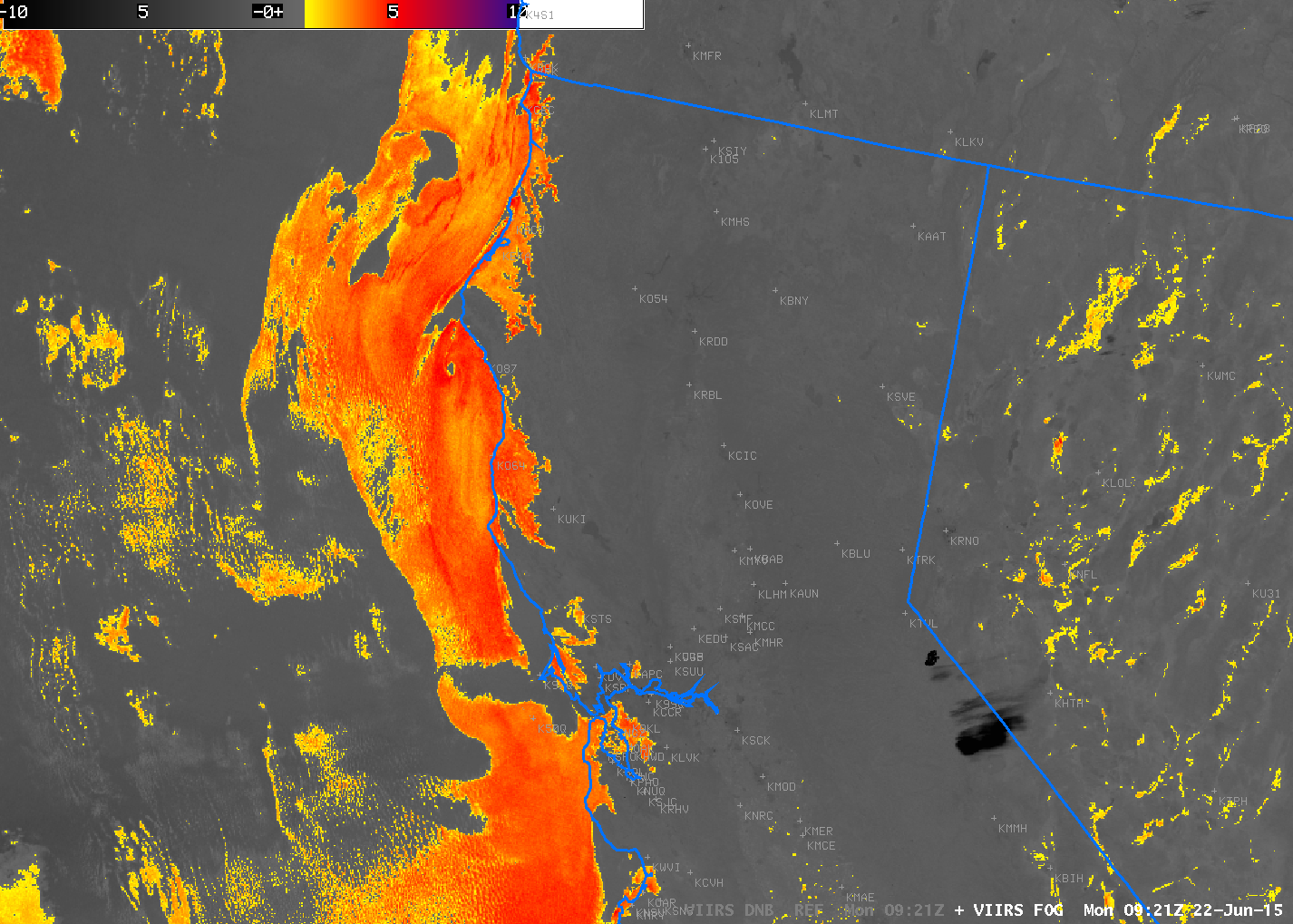
Suomi NPP Day/Night band imagery, Brightness Temperature Difference Fields (11.45 µm – 3.74 µm), and 3.74 µm Image, 0921 UTC on 22 June 2015 (Click to enlarge)
Suomi/NPP’s early morning overpass also detected the presence of fog/low stratus over the valleys along the northern California coast. The Brightness Temperature Difference field shows things distinctly. The Day-Night Visible imagery shows little in the way of fog on this day, as the waxing crescent moon had already set so no lunar illumination was present. The Day Night band is included here because it shows a very bright wildfire south of Lake Tahoe. That feature is also present in the 3.74 µm imagery. Fog and stratus is also evident in the 3.74 µm imagery, detectable based on its very smooth appearance.