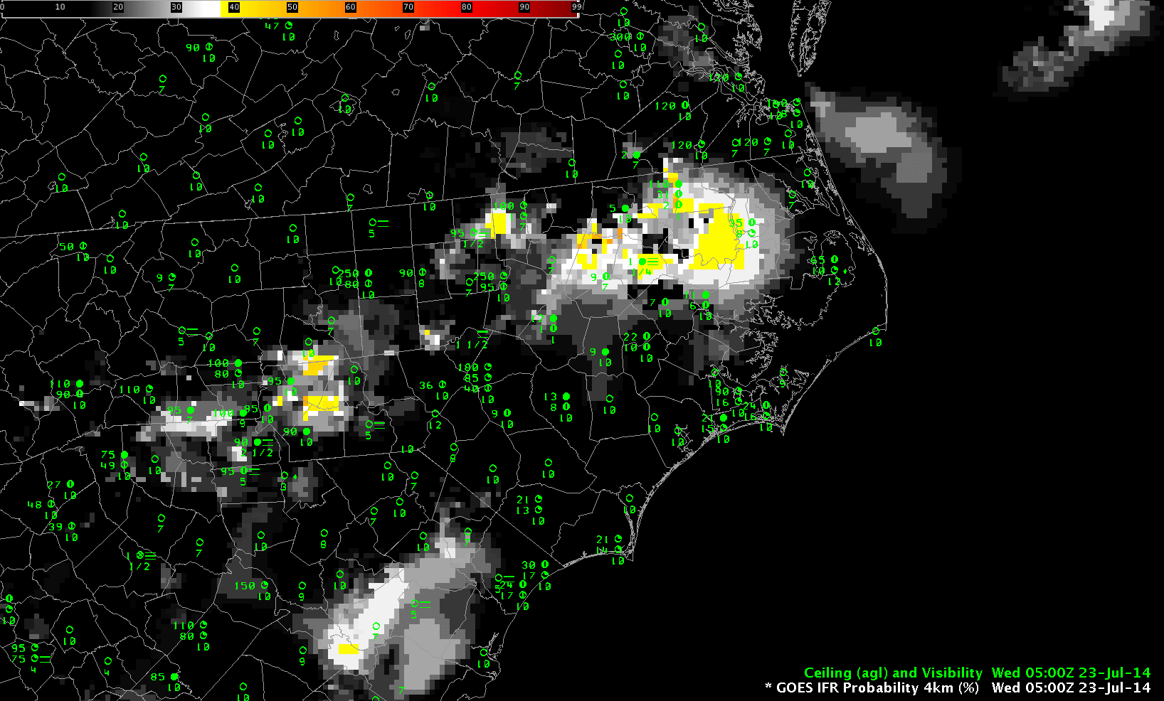
Hourly imagery of GOES-R IFR Probabilities over North Carolina, 0500-1400 UTC 23 July 2014, including surface observations of ceilings and visibilities
Low ceilings and reduced visibilities developed along the North Carolina piedmont during the morning of July 23rd. GOES-R IFR Probabilities showed the stripe of low ceilings/reduced visibilities extending northeast to southwest along the Piedmont. Observed IFR and near-IFR conditions roughly correlate with higher probabilities in the field displayed. Note that probabilities increase between 1100 and 1200 UTC, when the Sun rises and different predictors are used to compute the fields.
In contrast, the brightness temperature difference field (below) does not have a strong signal, it would be difficult to use the fields to predict where fog/low stratus would be.
GOES-R IFR Probabilities allow a better description of where fog/low stratus exists because of the use of Rapid Refresh data as a predictor of fog. In cases where the satellite signal is not strong, such as this one, saturation information from the model adds critical information.
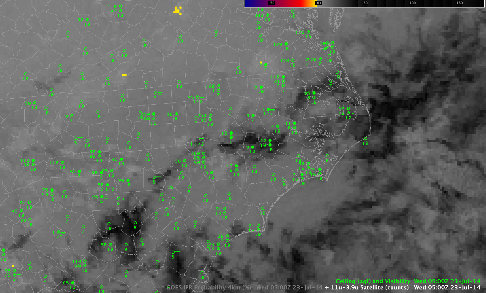
Hourly imagery of GOES-13 Brightness Temperature Differences (10.7 µm – 3.9 µm) over North Carolina, 0500-1400 UTC 23 July 2014, including surface observations of ceilings and visibilities