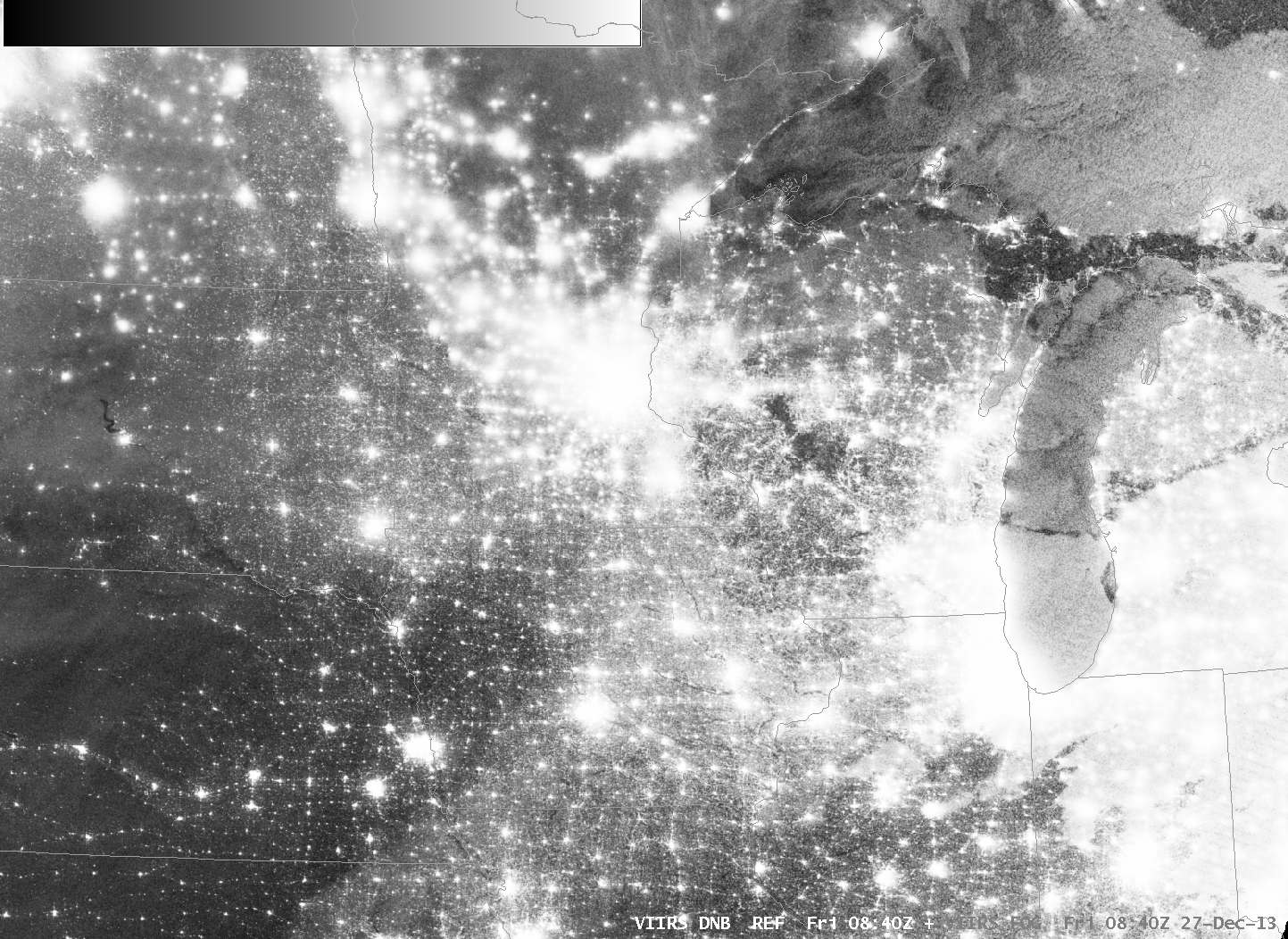
Suomi/NPP Brightness Temperature Difference (11.35 µm – 3.74 µm) Brightness Temperature Difference and Day/Night Band, 0840 UTC 27 December 2013 (click image to enlarge)
At times of low lunar illumination, it can become increasingly difficult to discern regions of clouds and snow in the Suomi/NPP day/night band, shown above, toggling with the brightness temperature difference. Nevertheless, careful perusal of the image reveals cloud edges over northeastern Wisconsin and through central lower Michigan that are confirmed by the brightness temperature difference field. In contrast, the whiter region that stretches southwestward from Des Moines towards extreme northeastern Kansas has no signal in the brightness temperature difference field. This is snow on the ground (vs. little snow to the northwest).
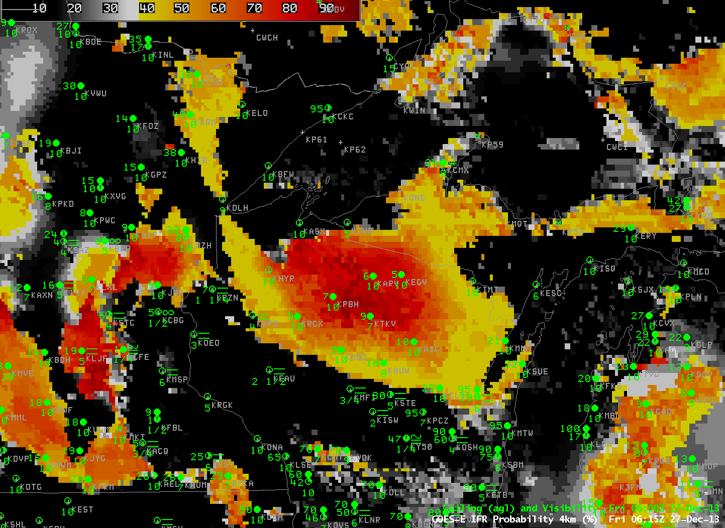
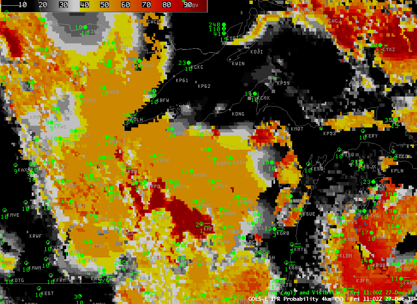
GOES IFR Probabilities computed with GOES-13 data, hourly from 0615 UTC through 1302 UTC, 27 December 2013 (click image to enlarge)
IFR Probability fields and GOES-Based brightness temperature difference fields are produced to aid in the detection of low clouds. In the animation above, higher IFR probabilities are centered on north-central Wisconsin where, intially, IFR conditions are not quite met (according to the plotted observations of ceiling and visibilities). However, as the night progresses, ceilings lower and visibilities decrease as IFR conditions do develop in regions where IFR Probabilities are high. The IFR probabilities roughly overlap the region where IFR conditions exist.
Note that encroachment of higher clouds in from the west, starting around 0800 UTC, means that satellite data cannot be used in the IFR Probability algorithm. Because only model data are used, IFR probabilities drop from values at/above 80% to values between 50 and 60% even as IFR conditions come to be more widespread. For this reason, it is important when interpreting IFR Probabilities to be alert to the presence of high clouds.
IFR Probabilities give a much more better approximation of where fog/low stratus may be occurring than a simple brightness temperature difference field. The toggle between the GOES-R IFR Probabilities and the GOES-13 Brightness Temperature Difference, below, gives testimony to this.