 |
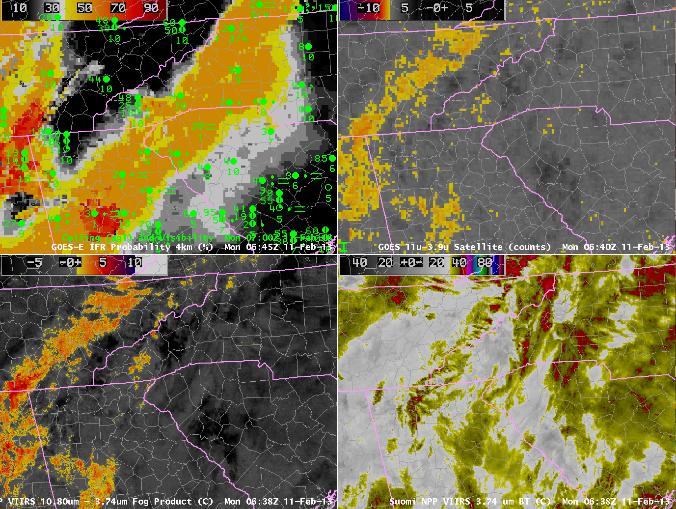
| GOES-R IFR Probabilities computed from GOES-East and Rapid Refresh Data, and surface observations of ceilings and visibility, 0645 UTC-0700 UTC on 11 February (Upper Left), GOES-13 Brightness Temperature Difference, 0645 UTC (10.7 µm – 3.9 µm) (Upper Right), Suomi/NPP VIIRS Brightness Temperature Difference (10.8 µm – 3.74 µm) at 0638 UTC (Lower Left), Suomi/NPP Near IR Imagery (3.74 µm) at 0638 UTC (Lower Right) |
The image above is a good example of the importance of fused data in many fog/low stratus events. The near IR imagery, bottom right, shows many different cloud layers. A strong storm moving towards the East Coast on Monday morning 11 February generated many cloud layers that make the traditional method of fog detection, the brightness temperature difference between 10.7 µm and 3.9 µm, problematic. Adding information from the model, however, allows the GOES-R product to identify the region of IFR conditions that extends northeastward from central Georgia to central Virginia.