 |
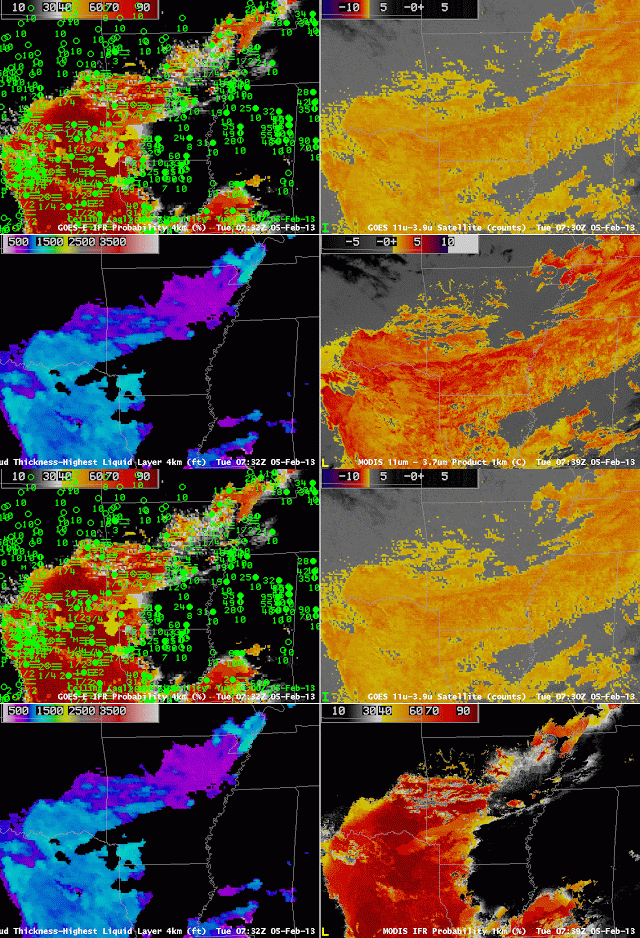
| GOES-R IFR Probabilities, from GOES-East (0732 UTC) and 0800 UTC Surface observations of visibility and ceilings (Upper Left), GOES-E Brightness Temperature Difference (10.8 µm – 3.9 µm) (Upper Right), GOES-R Cloud Thickness (Lower Left), MODIS-based Brightness Temperature Difference (11µm – 3.74 µm) GOES-R IFR Probabilities computed using MODIS data (Lower Left, 0739 UTC) |
|
IFR conditions developed over Arkansas and surrounding states overnight from 4 into 5 February. Compare the brightness temperature difference (the traditional fog-detection product) over southeast Arkansas (where IFR conditions are not occurring) and over southwest Arkansas (where IFR conditions are present). Although the satellite signal is very similar over the region, surface observations are very different. The GOES-R algorithm distinguishes between the region with IFR conditions (east Texas, western Arkansas, northwest Louisiana) and the region without IFR conditions (southeast Arkansas, northeast Louisiana).
On the flip side, in regions over northeast Arkansas, where the brightness temperature difference product is not showing low clouds, IFR conditions are present, and the GOES-R IFR probability is elevated.
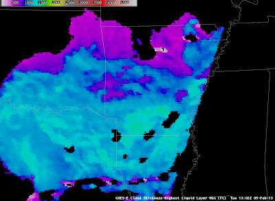 |
| GOES-R Cloud Thickness over Arkansas just before Dawn — note that dawn has arrived over Tennessee and Mississippi |
Cloud Thickness just before twilight conditions can be used to predict when radiation fog will burn off, using this scatterplot as a guide. The maximum thickness over south-central Arkansas is 1350 feet, and that thickness corresponds to 5 hours after sunrise, or sometime after 1800 UTC. The animation of visible imagery, below, shows that fog/low clouds are lingering over parts of southern Arkansas.
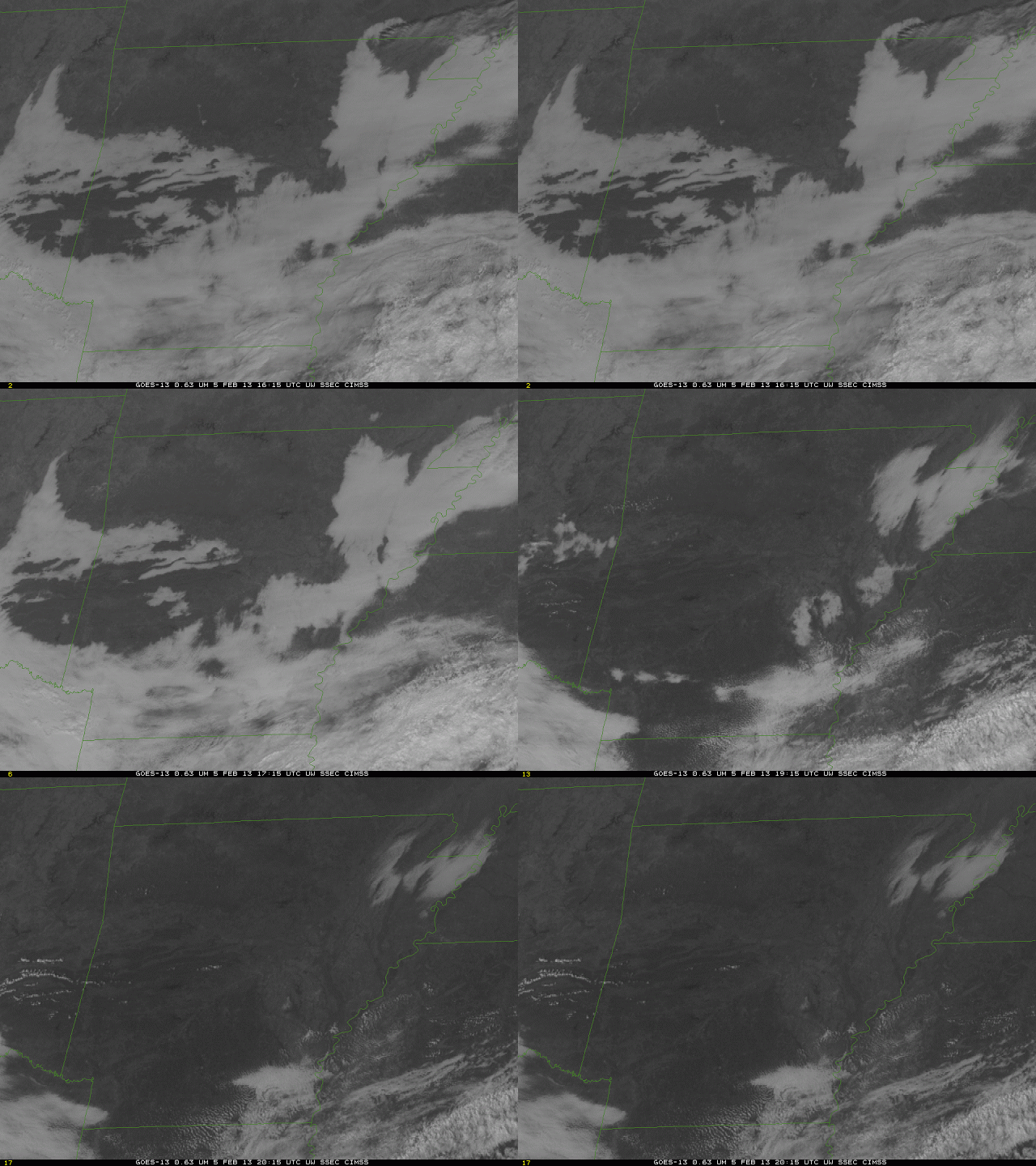 |
| GOES-13 Visible Imagery over Arkansas, times as indicated. |
